Archive for Places to go
July 23, 2006 at 9:18 pm · Filed under Places to go
Perhaps we are turning the corner on luck. Our drive along I-80 in Wyoming was uneventful, which lately is unusual for us. We stopped and checked those darn lug nuts at 10, 20, 30, 50, 70, 100, 150, and 200 miles. At the first few stops, 2 or 3 of the new ones I installed would move a tiny bit, but eventually they all seated and stopped moving. That’s normal, according to everyone I talked to.
So hey ““ I fixed my own trailer and I got 200 miles without a problem. And now I know exactly what to do if this problem ever recurs. That’s a great feeling!
The only bad luck today was at the last lug nut check. After I checked them, the new torque wrench fell apart in my hands. Apparently one of two screws that holds the assembly together vibrated out during travel. It has disappeared. The other fell out roadside and the next thing I knew, little springs and cogs were sprinkling down by my feet. We gathered all the pieces for re-assembly, but I may buy a better quality torque wrench instead.
If that’s the worst thing that happens, I’ll be grateful. Hopefully I can turn this blog back to the enjoyable part of traveling. (Although I must admit there’s a unique satisfaction in having rescued oneself, by doing a repair on your own trailer with your own hands “¦as long as the opportunity doesn’t present itself too often!)
I-80 in Wyoming is a vast arid landscape dotted with gas tanks and other signs of the petrochemical industry. The Green River Valley area is the hub of oil shale in this country, and we saw plenty of action out there. Further east, there’s a refinery in Sinclair, and all along the Interstate there are yellow Union Pacific diesel-electric locomotives running east-west with long trains behind them.
I suppose some people would call this landscape boring, but I liked it. I guess today I would have liked any landscape that we were not broken down in.
The camping options along I-80 are horrible. Most of the campgrounds are desolate gravel parking lots right next to the highway, with the requisite noise all night long, and sites so jam-packed you can reach out and touch your neighbor. For a view, choose from Interstate highway or oil tanks.
We were flying without a plan today, because we honestly didn’t know how far we’d get. By 4 pm we were in Laramie and I decided to follow Garminita’s advice to take Rt 287 south from there into Colorado. It looked like a nice scenic and quiet roadway, which might present interesting boondocking possibilities.
That was a great decision, if I do say so myself. Take Rt 287 south from Wyoming sometime. Once the road crosses into Colorado, you enter the most marvelous landscape of layered and eroded rocks, stacked like pancakes among the evergreen landscape. It is beautiful, open, and unpopulated. I kept thinking, “Why isn’t there a state or national park here?” It’s that nice.
About 20-30 miles into Colorado, somewhere between Virginia Dale and Livermore, we passed a white sign that said, “Cherokee Park.” WHOA. I hit the brakes, made a U-turn, and down the red dirt Cherokee Park Road we went.
I was hoping we’d make another “find” like we did last October in Iowa when we found a little county park way out in the farmlands, and had one of the most lovely nights of boondocking we’ve ever enjoyed. We had no information on this Cherokee Park other than the sign: no idea where to find it, how far down the road it would be, whether we could park there overnight, or even if we’d be able to turn around. But if you want to find the places “off the beaten path” you’ve got to be willing to take a chance on the unknown.
The red road twists among the fantastic rock formations, and climbs briefly at what I would guess is about a 10-12% grade. We had to switch to 4WD mode to keep the rear wheels from slipping. About 6-8 miles along, Cherokee Park Road descends and brings you by a dirt parking area with a set of signs that identifies the Cherokee State Wildlife Area, Lower Unit.
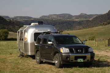
Parking in the lot is OK for up to 14 days, according to the signs. You can leave your rig unattended for 48 hours to go exploring. This is horse country, but an ATV would work well too. The scenery is fantastic. The spot is quiet and isolated. It’s great boondocking, and if we had more time I am certain the hiking would be superb as well.
One caveat: you are supposed to have a “Habitat” sticker to use this area. We’ll buy one, to atone for our minor sin of parking here without one. I think buying a sticker which supports the preservation and access to such beautiful lands is a small price to pay.
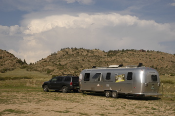
There’s only analog cell phone service here (and not much of that), so this blog entry will be posted in the morning as we head to Aurora CO. Other than running some backups on the computer and typing up this entry, I’m taking a night off. After all the stress of the past few days, I need a little break before the work week begins. This seems like a nice place to relax.
July 18, 2006 at 11:50 am · Filed under Places to go
Now I have to take back a lot of what I said yesterday. I said Victor doesn’t have any Internet — but in fact there’s a lot of free wi-fi all over town. I’m in the public library now, which has the fastest public Internet I’ve ever experienced. And everyone in the downtown area has an open wireless network, so there’s plenty to borrow. Rich C asked around and nobody seems to worry about it.
I also put my blog entry in the category of “Places to Avoid”, but I was really thinking of the Teton Pass. Avoid that with a trailer. But Victor ID, and the nearby town of Driggs, are really wonderful places to visit. We are in the midst of a huge valley, on the west side of the Tetons. Here the jagged peaks of the Tetons are mostly hidden behind rounder green foothills. The view is vast and gorgeous, with dry clear air and lovely sunsets over the low mountains to the west.
The people are friendly, there are no mosquitoes, and there seems to be little pollen this time of year. Eleanor and Rich C are loving it. Emma likes the swimming pool and the foosball table (we all had a foosball tournament last night.) So we’ve decided to stay a few more days to catch up on work and enjoy the fine weather.
But everywhere there are the subtle signs of a place with a real estate boom ready to happen. There’s a Sotheby’s Real Estate office in both Victor and Driggs. The highway has been widened in the towns. New development is happening everywhere, with large parcels of land already sprouting golf courses and huge “rustic-style” log homes. The tourist atmosphere of Jackson seems ready to spread to this side of the mountains.
We’d consider buying some land here if it were a place with a warm winter, but they get plenty of snow here and snow no longer interests me. This won’t be a place we settle down, but it is a peaceful spot to hang out in the summer. I hope Victor and Driggs can remain quiet little western towns for a long time, but I think the folks at the Highway Department, Sotheby’s, and the two log home companies on Rt 33, are all working to change that.
Last night, after I finished working in Jackson at the music/tattoo/Internet/cafe, we drove around the Victor/Driggs area to explore. One of our “finds” was the local Spud Drive-In Movie Theater, with the biggest potato we’ve ever seen.
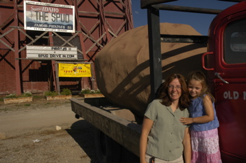
I also dropped in our neighbors who work-camp here. Spencer was a lawyer for 40 years in Minneapolis, but retired and re-trained as a barber. Once he had his Master Barber’s License, he and his wife Ingrid hit the road in their fifth wheel. They spend every winter in Mazatlan Mexico, and summers here in Victor. Ingrid works in the office and Spencer does other duties, in addition to providing good haircuts for $10. It was a unique experience for me to get a haircut under the awning of an RV on a warm summer afternoon, and chatting with Spencer about his winters in Mexico made it even better.
July 13, 2006 at 7:15 pm · Filed under Places to go
I have to admit that I arrived in Yellowstone with less than the appropriate attitude. Part of it was my fault: I never took the time to research the park before we arrived, and so I was repeatedly surprised by things that I should have expected.
As we passed through the North Entrance, I was expecting to drive a few miles to our campground and settle in before the thunderstorms arrived. But Yellowstone is a park the size of Connecticut, and so I should not have been surprised to see a sign advising us that the drive to Bridge Bay Campground was 62 miles further down a twisting road with a speed limit of 35-45 MPH.
Along the way, we passed through Mammoth Hot Springs, the northernmost of several “villages” that exist inside the park. To visit a park the size of Yellowstone (we belatedly discovered) you need to pick an area you want to explore and then choose a village nearby. Otherwise, you’ll spend all day driving around the park. It is typically 35-50 miles between villages, and traffic sometimes moves slowly in the peak months of July and August.
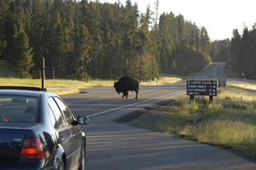
Bison can cause huge backups in the summer
It moves even slower when a bison crosses the road. We got caught in a series of thunderstorms, with small hail — which always strikes fear into the heart of an Airstream owner — and then of course, a bison showed up somewhere, and all traffic stopped dead. There’s nothing like watching hail hit your trailer in a mile-long traffic jam with no way to escape. So we arrived much later than we expected, and I was not feeling very upbeat about it.
We found Susan and Adam in their campground, 2 miles from ours, but they had decided to depart in the morning, so that was the last we saw of them. We were sorry to see them go, but glad they felt they had a great adventure with us the past ten days.
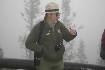
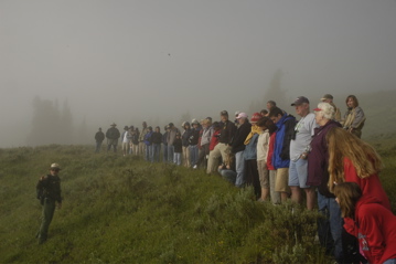
Knowing that crowds and traffic were going to be problems, we woke at 5:30 the next morning so we could get to a Ranger-guided hike at 7:00, about ten miles away. We figured the early start time would allow us to see lots of wildlife, and it would keep the crowds away. We were wrong on both counts. Over fifty people showed up, and the fog was so dense we couldn’t see anything most of the time. There’s no chance of spotting much wildlife with fifty people tromping around anyway …
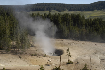
Dropping in on the other roadside sights worked better for us. We hit the Sulphur Cauldron, the Mud Pots, and a few geysers, did a little more hiking, and then we started to feel that you can only look at so much belching mud in one day. We collapsed in the trailer for lunch and a nap (for me).
In the afternoon we were surprised by Wendimere “The Health Chic” and Bill, who we had met in Salem just a couple of weeks ago. We spent an hour chatting with them and talked about meeting up again in Florida, where they live. From here the plan is a quiet evening in, some movies, and early bedtime … because tomorrow will be another early day.
July 10, 2006 at 1:07 pm · Filed under Places to go
You may have noticed that I didn’t post last night. There’s a good reason for that: total exhaustion. Following Bert’s recommendation, we all got up at 6 a.m. and were driving toward Glacier by 7:30, to beat the crowds. Glacier is getting sadly overcrowded on the only road that goes through the park, namely “Going To The Sun Road.” An early start saves a lot of time by avoiding the traffic.
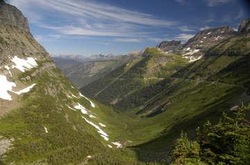
One of our first views from the hike. Click to enlarge
Now, the plan was supposed to be that we would spot a car at a hairpin turn in Going To The Sun Road, then proceed up to the Visitor’s Center at Logan Pass, and hike generally downhill for about eight miles along the Highline Trail back to the first car. However, Bert somewhat underestimated the mileage for the hike … which turned out to be about 12 miles … and also neglected to mention that about 1/3 of the hike was along trail with 1,000 foot drops along the left edge.
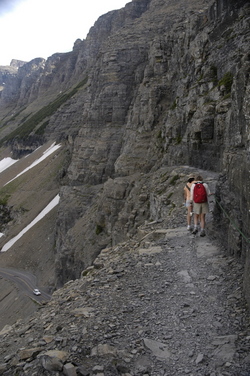
This made for a spectacular view, but a nerve-wracking hike for Eleanor and I. Emma is a superb hiker, and can easily cover six miles in a half day, but we’ve never even dreamed of taking her 12 miles! Plus, we had to hold her hand tightly through some tricky spots. I was envisioning her slipping down the nearly-vertical slope and jumping down after her, so at times my grip was tight.
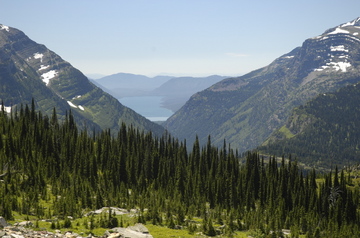
Lake McDonald in the background. Click to enlarge
But Emma was a trouper. Not only did she safely hike 12 miles with 600 feet of vertical gain and 2900 feet of descent, on a day that approached 90 degrees, but she did it in good spirits … wearing sandals. (I was wearing sandals too, and neither of us had a blister or even a sore toe.) Not bad for a six-year-old, eh? We’re very proud of her, and our hiking partners Adam, Susan, and Bert were very impressed. Bert was so impressed that wrote about Emma in his blog, which you can read by clicking here.
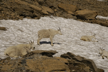
Mountain Goats resting nearby. Click to enlarge.
This was more than a hike, it was an adventure. Bert, being a former ranger in the park, was full of interesting information about the wildlife, plants, geology, and history of the park. We really got more than our money’s worth out of the day.
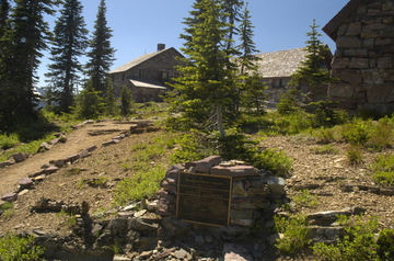
The historic chalet, about 6.7 miles down the hike. Click to enlarge.
The best thing about this hike may have been the ending: just a few hundred feet short of the trail’s end, when we were all hot and sticky, we found this superb cool stream. I immediately ran down and dunked my head in the water. Ahhhhhhh…. Bert and Adam quickly followed suit, and Emma filled her hat with water and poured it over her head. At point, we all felt refreshed enough to hike a few more miles.

I have posted an entire new album of photos from this hike on Flickr. Click here to see the pictures. If you can’t browse the pictures now, suffice to say that Glacier is a wonderful park, huge, gorgeous, and filled with waterfalls from the melting snow.
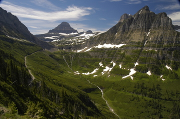
Another view from High Line Trail. Click to enlarge
Glacier is also logistically tricky. To see it, you really need to go hiking. Driving the Going To The Sun Road is great and there are many pullouts to see waterfalls, goats, and fantastic views, but that’s only a tiny sampling of what the park has to offer. And it’s a huge park — just driving from the West Glacier entrance to Logan Pass is over 20 miles.
We can’t tow the Airstreams through the park. Our next goal would be to travel to the east side, where Many Glacier can be found, but since we have to detour around the park, this would be at least a three-hour trip. After thinking about it, we’ve decided that we are satisfied with our very full day and we will save the rest of the park for another visit.
Today will be a work day and then tomorrow we plan to start heading south to Yellowstone. Adam and Susan have already headed out, since they have less time than we do. We’ll caravan with Rich C. Bert & Janie are heading out too, for several months of work on the road writing and photographing subjects from Montana to Nova Scotia, and then down the east coast. We are hoping to meet them again in Maine, in September.
Last night, after getting the second car and driving to the West Entrance, it was about 7:30 pm. We drove over to Kalispell (35 miles away — things are spread out in Montana) for pizza at Moose’s Saloon. If you ever get to Kalispell, check this place out. It looks disreputable, but the pizza is great and the atmosphere is fun. The floor is covered in sawdust and peanut shells, the music is loud, and it’s a great place to get the two things Bert wanted most after our 12 miles of hiking: pizza and beer.
When we finally emerged from Moose’s, it was 10 pm and the sun had just set. It wasn’t completely dark until 10:30. In this time of year, Montana seems to understand that your days will be full, and it obliges with plenty of sunlight.
June 20, 2006 at 10:12 pm · Filed under Places to go
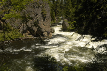
Everyone said, “Oh, Bend is great!” so here we are … and so far it has been a nice place for us. Today’s trip just south of town brought us to the National Forest and a short hike along the Deschutes River to Benham Falls. The hike was great except for a few mosquitoes, and the scenery was superb so I think tomorrow we may hit a few other spots along the river as well.
Like a lot of other National Forest sites these days, there is an access fee required now. In this area they sell something called the “Northwest Pass” for $30 or you can buy daily passes for $5, which is highway robbery in my opinion. It is not nearly as well advertised at the forest sites that the good old National Parks pass will work just fine if you have the “Golden Eagle Hologram” on the back. The hologram is only $15 more than the basic National Park pass and it gets you unlimited access to any National Forest site that charges an access fee, for a year. You just leave it on the dashboard, hologram side facing up.
After the waterfall hike, we checked out the High Desert Museum ($12 adults, $7 kids). This is a good one, comparable to the Sonoran Desert Museum in Tucson, but with more emphasis on western life than on wildlife. Gordon, one of the volunteers, met us at the entrance to their “Western Life” exhibit and gave us a complete tour of the entire wing, just because he likes to. It was a great experience and extremely educational. That alone was worth the price of admission.
The museum says to allow 3 hours to see everything but we were there for over four hours and had to rush at closing time to see the raptors before they kicked us out. Fortunately, admissions are good for two days.
Our campground, Tumalo State Park, is a pleasant enough setting, but overly popular because it is so convenient to Bend. Even mid-week the place is full and during the afternoon and evening it’s a zoo with kids, trucks wandering through, and parents yelling at kids. The sites are fairly close and competition for a space is fierce. Non-hookup sites are $17 and full hookups are $20 — the sort of weird pricing we often see in State Parks. Of course, everyone wants a hookup site, and of course they are all reserved until approximately the end of time.
Their policy is also that we aren’t allowed to renew our non-hookup for more than one day at a time. We’ve had good sunshine and so our solar system is providing us plenty of electricity to stay for a few more days, but after tomorrow I think we’ll have done what we wanted to do in Bend. We’ll spend one more night and then head west.
June 19, 2006 at 7:23 pm · Filed under Places to go

Crater Lake. Click for larger
I’ll preface this blog entry by saying that I simply can’t do justice to Crater Lake in words or pictures. As soon as I post this I will start uploading selected photos to Flickr, so you can see more. But in short, it is spectacular.
The entire central Oregon area is great: wild rivers and lakes stocked with trout, rafting, hiking, huge forests of lodgepole pine, ancient lava flows, and cheap National Forest campsites everywhere. On the drive up from the Rogue Valley we stopped at waterfalls and gorges, even a spot where the Rogue River goes underground and then re-emerges downstream.
But the crown jewel is undoubtedly Crater Lake. The most convenient campgrounds to Crater Lake are the park’s Mazama campground or, just north, Diamond Lake. We stayed at Diamond Lake, which has both a cheap National Forest campground ($10, no hookups), and a full-hookup RV park. Both feature views of Diamond Lake, and a few very large mosquitoes. The RV park has free wi-fi near the entry building, but I didn’t realize that until it was too late.
Since Diamond Lake is about 5,100 feet, the temperatures are cool and comfortable. Up at Crater Lake, nearly 2,000 feet higher, there’s still a lot of snow left. The park gets an average of 44 feet of snow, so some of the roads were still closed. The park won’t fully open until July. It was in the 50s and 60s while we visited — a nice day for Crater Lake in June.
The short season of the park (unless you are into winter sports) was a small problem for us, since all the hiking trails were closed, some of the facilities were undergoing renovation, and the Rim Drive that circles the crater was definitely off-limits. With few things to do, our visit was basically a couple of hours on Saturday afternoon, and a few hours mid-Sunday. Mostly, we gaped at the view and took pictures.
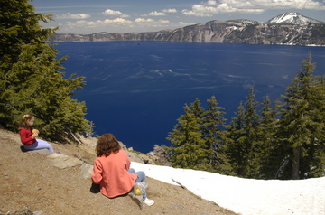
Our lunch stop. Click for larger.
The water of the lake is exactly as blue as it appears in the pictures. Photo notes: you’ll want a circular polarizer, and this is the place to set your camera on Aperture Priority mode. I tried to get F13-22 for most of the long shots.
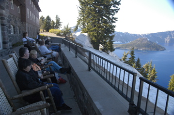
The Lodge at Crater Lake looks like a great place to stay if you don’t have an RV. It’s really a completely rebuilt replica of the original lodge, which was a structural disaster. This one retains the lodge feel with great stone fireplaces and exposed wood everywhere, but with more modern conveniences. Even if you’re not a guest, you can sit out by the lake and admire the view for the price of any drink from the restaurant’s bar.
Sunday we met a few Airstreamers who, like us, are headed to Salem for the big rally. One couple, Rickie and Yank, are in a Safari 28 formerly owned by John Ratzenberger (of Cheers fame). We’ll try to meet up with them again in the nearby town of Sisters later this week.
I also just heard from Colin Hyde. He worked on Vintage Thunder last year and will be working on Vintage Lightning this year. He’s planning to come to the International Rally for a few days to help show off a 65 Caravel he just restored for a client.
Tonight we are in a state park in Bend. Our plan is to use this as a base for most of the week, since there’s a lot to see and do in this area.
June 14, 2006 at 7:49 pm · Filed under Places to go
We’ve bought our last tank of gas at $3.47 per gallon, I hope. We’re in Oregon now, and things are cheaper here. Now, if we could only improve the weather….
The drive on Rt 199 from Crescent City CA was as scenic as I expected, at least through the first 35 miles or so. During that time you are in the northernmost part of the Redwood National Park, and the road winds through the big trees and along a river. Then you move seamlessly into National Forest, which is also terrific. It wasn’t as nice as Rt 299 in California, but it was majestic and cool in the fog, and worth the drive.
Once the road crosses into Oregon it is markedly less scenic, since the National Forest ends there and various signs of rural life appear along the roadside. Ten miles later, the tiny tourist town of Cave Junction appears, and the dead-end 17 mile Route 46 that leads up to Oregon Caves National Monument.
Oregon Caves is not a convenient stop, but then, few of the good national parks are. The nearest camping is where we spent the night, at Grayback Campground ($16, no hookups, no dump) in the Siskiyou National Forest. This is 10 miles up Rt 46. Trailers and motorhomes are discouraged from going any further, and taking a 30-foot trailer such as ours up the rest of the road would have been downright crazy.
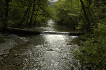
Grayback is a very nice place, bordered by a wild river, filled with tall pines and mushrooms, damp and primeval and shady, and normally we would love a place like this. But we’ve all had enough of shade lately, and so it was hard to get excited about another day in the gloom and cool. Especially since all of us still have colds.
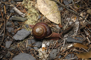
Still, it presented me with numerous easy photo opps. There’s a particular type of snail that was visible in several places: the Roth Snail. These big guys (about 2″ long) leach calcium from the local marble as they march slowly along. They use the calcium to build colorful red shells of calcite for their homes. We were fascinated to see how they can completely retract their stalks and faces when they are scared.
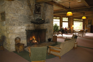
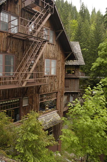
Seven miles up a very twisty and and narrow road, and a couple thousand feet up, are the Oregon Caves. It’s a good tour (free with the National Parks pass, by the way, otherwise $8.50 per adult). But the real gems of the place are the 1930s Chateau and Chalet buildings. These are real architectural masterpieces, made of huge douglas fir timbers and sided with redwood bark. The Chateau, six stories tall, seems to rise right out of the canyon as if it were planted there, and the river that exits the caves runs right through it.
You can stay in the Chateau overnight. It has more than a dozen hotel rooms, plus an elegant restaurant and a lunchroom. After our 90 minute cave tour, we were hungry and stopped in. (The tour includes 500 stairs, and it’s 42 degrees inside, so we had worked up an appetite.) It’s a great old-fashioned place to eat.
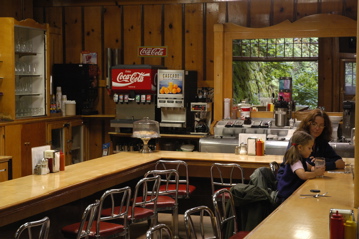
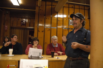
During lunch, Joe the maintenance guy responded to Eleanor’s question about the famous mudslide that nearly destroyed the hotel in 1964. He got into the whole dramatic story, pointing out parts of the Chateau that were damaged. (The building was nearly pushed off its foundation.) It’s a great story.
By this time it was 2 pm and the fog had turned to rain. The temperatures never got above 48, so we sloshed back to the truck and drove back down the National Forest campground to fetch the Airstream.
You’ll notice we aren’t driving the long distances lately. Our longest tow since Reno has been about 100 miles. We don’t need to be in Salem until the 26th, so we are meandering a bit. This saves gas money and it’s also a lot nicer. Why rush if you don’t have to?
So our tow today was only 40 miles or so, to Valley of the Rogue State Park near Grant’s Pass, OR. This is a grassy, manicured park with full hookups near I-5 ($20/night). We’ve selected a quieter site toward the back with just water & electric, and prepaid for three nights. We chose this park because it is convenient to services and along our route to Crater Lake. We need to re-stock a few things, plus I want to give everyone a couple of days to get rid of these darned colds.
I also need to get some work done. We are in the final stages of the Summer magazine issue, and everything goes to the printer on Friday. Once that’s done, we’ll head up to Crater Lake for the weekend and then up to Eugene on Monday.
« Previous entries ·
Next entries »


