Archive for Places to go
May 18, 2006 at 11:15 pm · Filed under Places to go
Our campground last night, Rancho Sedona, distinguished itself in two ways today. First, it became only the second campground advertising wireless Internet which had a signal strong enough to penetrate our Airstream’s aluminum skin. Second, the sewer drain didn’t. So when I pulled that black handle “¦ well, let’s just say it wasn’t pretty.
Turns out they have what they euphemistically refer to as “a delicate septic system.” Apparently when somebody downstream flushes the wrong thing, everybody upstream has a bad day. The service guy came over and did what you do at home: he plunged their drain line. He told me that the last time he was called out, it was a screwdriver in the line. People flush weird things.
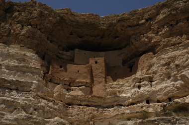
We took the southern route out of Sedona to see more of the great scenery and to visit Montezuma’s Castle National Monument as well. The monument is small, basically consisting of ancient Native American cliff dwellings, and a good Visitor’s Center. The temperatures were flirting with 100 while we were there. I leaned against a brown metal railing and burned my elbow.
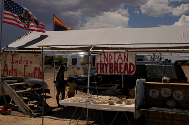
Just outside the Monument is one of the ubiquitous Native American casinos that dot the western landscape, and an open parking lot where we found a family selling frycakes and handmade jewelry. We’ve been seeing these frycake stands often since we entered New Mexico and Arizona, and since it was lunchtime I proposed we stop and try a few.
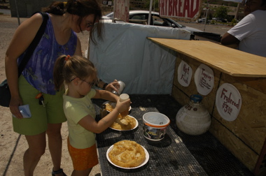
They’re a little like the fried dough you get at county fairs, but lighter, crispier, and not nearly as nauseating afterward. I buried mine in honey, Emma chose cinnamon sugar, and Eleanor mixed powdered sugar and salt for a kettle-corn sort of flavor. They were all great.
Then it was northward. I-17 rises as it approached Flagstaff, which is nothing like what I expected. Being up around 6000 and 7000 feet, the area is green with pine trees. The centerpiece is a peak 12,000 ft tall with snow at the top. Then Route 89 floats gently down to 5000 feet as it goes through National Forests and tribal reservations, including the large Navajo Nation.
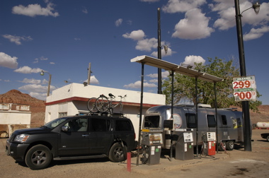
The route to Page, AZ is beautifully scenic and often rather lonely. The Echo Cliffs parallel the road on the eastern side, and little villages populated by Native Americans are the only breaks in over 100 miles. Coming into Page, a town founded as recently as 1957, you are rewarded with stunning views of red rock formations and eventually Lake Powell.
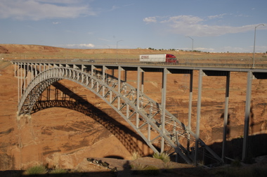
Lake Powell was formed by the Glen Canyon Dam, which you can walk across for a dizzying but gorgeous view of the canyon and lake below. There’s a Visitor Center but we arrived after it was closed.
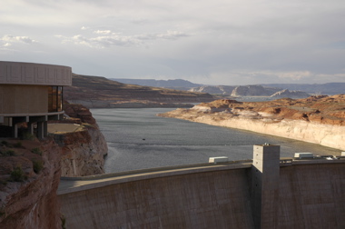
Just a mile down the road, we turned off for the Wahweap Marina area, which is part of the Glen Canyon National Recreation Area. Our National Parks pass with Eagle hologram got us in for free, saving $15. (That paid for the Eagle hologram right there.) Down the road are wonderful views of Lake Powell, the marina filled with houseboats, and Navajo Mountain.
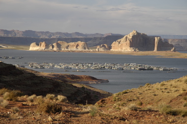
I was hoping for a free campsite somewhere, but even boondocking in this campground costs $19. For what, I’m not sure. Oh well, it’s lovely and quiet. Since this is a warm night, still 84 degrees at 11 pm, and we’ll have to sleep with the windows open, it should beat the noisy Wal-Mart Supercenter up the road, where we saw at least six $100k+ Class A motorhomes parked for free.
May 16, 2006 at 10:52 pm · Filed under Places to go
Petrified Forest National Park is a lonely exit off I-40 in eastern Arizona. A single road about 25 miles long leads from the north entrance to the south. We came here expecting to see lots of petrified wood, but were surprised how much more there is to be found.
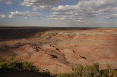
Right off the bat there are incredible views of badlands, and an historic Harvey House restaurant called the Painted Desert Inn. People used to get off the train about 20 miles south and travel by car to stay at this rustic adobe inn at the edge of the cliff overlooking the badlands.

Then we found a Native American pueblo dating from 600-800 years ago, with wonderful petroglyphs. While looking at those, a gorgeous California King snake came by (not venomous). We met a researcher in the parking lot who was studying snakes, so we took him over to the spot we last saw the snake. He already had a western diamondback rattlesnake in the car …
A few miles further down, we finally began to see the remains of forests of large trees, fossilized and slowly emerging from the eroding cliffs. Emma spotted two jackrabbits, a hawk, a cottontail rabbit, and other creatures for her Junior Ranger project, to be turned in tomorrow.
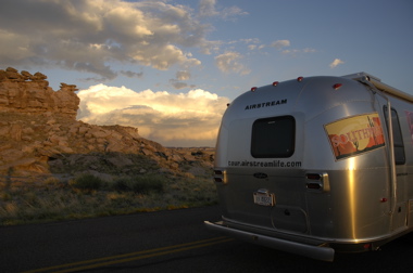
We’re boondocked just outside the park’s south entrance tonight. We ran out of time this evening, so we’ll head back about eight miles north to see the rest and do some hikes, before heading west to Sedona to meet up with Renee and Fred again.
May 16, 2006 at 12:59 pm · Filed under Places to go
This park is way up above Santa Fe, which is itself a pretty high-altitude town. The park is at 8700 feet, nestled in a cleft between mountains and surrounded by evergreen trees. The entire park has hardly any level ground. The few RV sites that it has are oriented so you have to back into them, up a steep slope. We found that you only get one shot at it. Backing a trailer up a hill is hard work for the transmission. The approach to the campsites is so steep that if you don’t get in your space the first time, you have to sit and wait for the transmission to cool off before trying again!
Now that we are parked, it’s a beautiful and peaceful spot. But since Rich C and I both need to get to work, we can’t stay here. (This working stuff is a nuisance.) Our cell phones report “NO SERVICE” and of course that means our mobile Internet doesn’t work either.
Knowing that we would be offline for the day, we stopped in Santa Fe about seven miles from the campground at a convenient roadside spot. I got online and made a few phone calls, and just as we were getting ready to leave, a local Airstreamer stopped by, attracted by the colorful graphics all over our trailer. Her name was Mary Jane and she was amazed that she’d never heard of Airstream Life magazine. So we gave her a magazine and had a nice conversation, and she offered to give us tips on what to do in town. This is the type of local contact that is worth more than gold.
I am reminded that out west the climate is dictated by altitude rather than latitude. At 8700 feet in the campground it was gray, windy, and wet, so we went into town where it was clearing, much drier, and at least 10 degrees warmer.
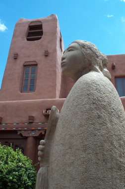
Santa Fe has a downtown that seems mostly composed of adobe buildings, but many of them are modern reproductions made of concrete. Still, it has a historic air and there is plenty to see. We just parked the car and walked the downtown for several hours, ducking into the various shops and markets. We finally got a southwestern-style rug for our Airstream, and I bought a leather hat which I plan to waterproof for rainy days. Emma likes it too.
As interesting as Santa Fe is, we are going to move on after just one night. We have only a week to get to Las Vegas and want to spend as much time in Zion National Park as we can, on the way. The state park, as pretty as it is, also lacks a few things besides being isolated from radio signals: the dump station is closed and sites don’t have water. It’s rather cold up here too. So basically we’re paying $14 per night for a parking space with electric. I’d rather be boondocking in the hot desert and using our solar system instead.
This is where we are going to split from Rich C. He has a minor problem with his truck that he wants to get resolved, and needs to wait until Wednesday for a part to arrive. By then, we’ll be 500 or more miles ahead of him, and he doesn’t want to rush. So he’s going to move to the KOA south of town, and we’re making plans to meet again in northern California for a few weeks before heading to the International Rally in Oregon.
This posting is coming to you from a lonely pullout somewhere between Santa Fe and Albuquerque. Our solar panels are finally getting tested, since I am running the laptop and our Internet box. We’re generating 11 amps at 11 a.m. local time in full sun, which is great. Our daily usage is about 20-30 amp hours, so with just a few hours of sun we can easily replenish what we need when boondocking. In the gray light of yesterday, we were generating 1-2 amps, which would still be enough to extend our batteries for several days. It’s encouraging.
May 15, 2006 at 1:23 pm · Filed under Places to go
Our route has once again intersected historic Route 66, “the mother road.” It’s easy to tell because the main drag through Santa Rosa is lined with old motels with neon signs, and all manner of businesses harping on the Route 66 mystique.
“Garminita”, our GPS with the British nanny voice, led us badly astray on the way to the state park. For some reason the database does not include the only road that leads to the park entrance, and so she sent us down a one-lane dirt road called “CR-1a” which intersects no other roads and essentially goes nowhere for about a hundred miles. We realized we were seriously off-route a few miles in, but couldn’t turn around.
A local came by in a pickup truck and we flagged him down. Apparently we were in the middle of an enormous ranch, over a million acres, and if we stayed on CR-1a we would eventually come to Las Vegas NM, which was quite a way north. We continued bumping down the dusty trail for another mile to a spot where it seemed we might be able to turn around, and executed a complex 7-point turning maneuver which involved considerable engine power, and liberal use of 4WD. The trailer is caked with red dust now.
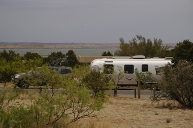
Santa Rosa State Park is beautiful, set high above an emerald-green lake formed by the damming of the Pecos River. Unfortunately, rain set in and the temperature dropped, so we didn’t spend a lot of time outside. The rain broke only for a few minutes but it was long enough to get some great rainbow pictures at sunset. (See our new windows?)
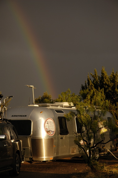
This area has been in a drought, but it seems to be breaking today. It rained all last night and has been steady all day today. We changed our plans to head up to Santa Fe for a couple of days. We’ll be staying in Hyde Memorial State Park tonight, but right now we are roadside to get email. Rich C is already parked at the state park and says as usual there’s hardly any cell phone coverage and no Internet.
I’m looking forward to some good southwestern chow tonight. Since it’s raining, we may go out for dinner in town. With luck, the weather will improve tonight and we’ll get some good photos tomorrow. Santa Fe is beautiful.
May 14, 2006 at 2:30 pm · Filed under Places to go
Our last few hours at Roger Williams Airstream were productive. Rich bailed out at his usual crack of dawn time, but as predicted, we just rolled over and kept on sleeping. David showed up around 8 a.m. and proceeded to install some bonus items: new stainless steel covers for the water heater and furnace.
The standard covers are fairly ugly steel painted a battleship gray color, which fades in the sunlight. Check out these before-and-after pics.
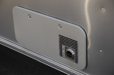
The ugly old cover
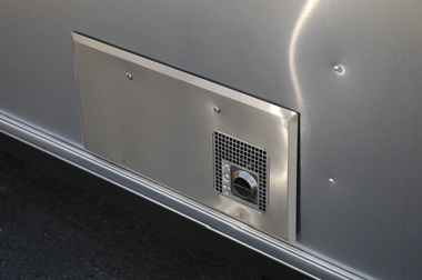
New stainless steel cover
If you want to get some of these covers for your trailer, check with David Tidmore at 817-596-0050. He’s had a bunch of them fabricated locally, and as far as I know, nobody else offers them. I think the pair (water heater and furnace) is less than $80.
David also helped us clean up some spots in the carpet (using an interesting product called “Dealersol”, but I’m not sure if you can buy it at retail), and the stainless steel parts in our trailer using a product called “ZEP” which you can apparently buy at Home Depot. (The stoneguards, refrigerator front, and stove front are stainless steel in our trailer.)
Finally, we took the rig around the block a few times to work in the disc brakes and adjust the brake controller. They start off braking poorly until the pads and rotors get worn a bit. After just a few miles the difference was amazing. It really STOPS.
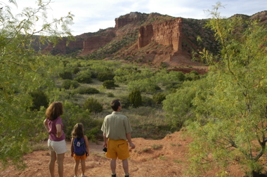
With all this, we didn’t get on the road until about 11. It was nearly 300 miles to Caprock Canyon, so we arrived way after Rich C, but he had a spot picked out for us, and had already scoped out the good stuff to see. There was still time to check out some great canyon views after dinner.
Now we’re trucking through New Mexico on our way to another state park tonight. Rich C is already there, and he reports that there is no Internet service (via cellular) in the park, so again I’ll have to post from the road tomorrow.
So far today we have covered a couple hundred miles and the disc brakes are now perfectly broken in. The difference is night and day, as I’ve been told. I’m really impressed. I can make a slow stop or slam on the brakes, and the effect is just remarkable — this 8000 lb trailer just smoothly comes to a halt without pushing us, or even letting us know it is there. I feel like it is a big safety improvement. Woo-hoo!
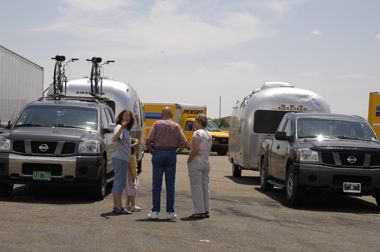
Stopping at a rest area off I-40, we met up with these folks pulling a 1972 Airstream Safari (single-axle) with a Nissan Titan. Very friendly … and it turns out they were just at Mystic Springs Airstream Park near Pensacola a couple of weeks ago, so we were able to talk about folks we both know down there. Their Safari is dented and rough on the outside, but very usable and they are having fun with it. That’s the whole idea!
May 2, 2006 at 8:47 pm · Filed under Places to go
Forget what you thought of Mississippi. It’s got some really interesting spots in it, and we found two of them today. First stop was the very large, high-tech, and impressive new Nissan assembly plant in Canton. Only opened to tours last month, this place is absolutely monstrous — and well worth the visit.
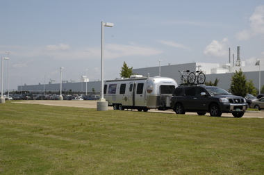
We parked right in front. (The nice thing about visiting auto plants with the trailer is that they always have plenty of parking!) I tried to take a photo of the trailer and the factory, but this place is so huge you need an airplane to see it all at once. You can see the north end of the factory building in the picture above …
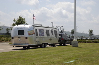
… and the south end of the building off in the horizon in the second picture. Believe it or not, that is all one giant building.
Of course the Tour trailer got a bit of attention too. While I was on the factory tour, somebody from the plant came out with a notebook and wrote down our URL. (Whoever you are, welcome!)
As with other auto tours, there’s no photography allowed inside, so you’re going to have to take my word for it that this is one awesome tour for anyone who likes to see stuff built, or who likes cars. Hundreds of industrial robots, sparks flying, giant metal presses five stories tall, and eventually 2,500 individual parts assembled into an American-made Nissan Armada or Titan. I got a nice feeling about our Armada, having seen how carefully it was built, and I got a good look at the innards (chassis, engine, transmission), too. I only wish I could have been there when ours was built!
The price is right: $free. But the tour is booked solid into September, so if you want to check it out, reserve early. And stop in on downtown Canton, just a couple of miles north of the plant on Rt 51. They’ve got an interesting downtown square with great historic architecture.
After a three-mile tram ride through the factory and two videos, I rejoined Eleanor and Emma back in the trailer where they were doing some homeschooling. I caught up on some work, and then we picked up the Natchez Trace Parkway just south of Canton and spent the afternoon slowly meandering down this very scenic road through 200 years of American history.
The Trace is limited to non-commercial vehicles, and the speed limit is generally 50 MPH, and it doesn’t really go anywhere in particular. So for the most part it is quiet and uncrowded, with gentle bends and plenty of historic pull-outs. We stopped about six times, taking one hike, and learning quite a bit about the history of this ancient trail from the interpretive signs. In about four hours we covered only 90 miles but it was some of the most pleasant driving we’ve done since we were on Route 1 in California. Even Emma liked it.
Our stop tonight is the Natchez Trace State Park, along the southernmost ten miles of the parkway. There’s a lot more north of our entry point at Canton, but we won’t get to drive it on this trip. We are going to exit at Natchez tomorrow morning. We have some extra time to explore as we head west this week, so our plan is to head into Louisiana and just let things find us.
April 20, 2006 at 9:41 pm · Filed under Places to go
Now, this is a nice state park. Coming from Jacksonville, you head west past the St John River and the little ferry that crosses it, over some salt marsh, and suddenly you are on Little Talbot Island, a tiny barrier of gorgeous sand and shells on the Atlantic Ocean.
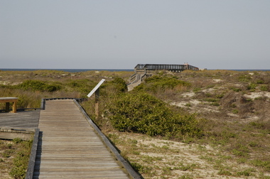
The park is across the road from the oceanside, bordering a creek. It’s a maze of tiny lanes which we had to navigate very carefully with our 30-foot trailer. Most of the sites are like ours: shady with overhanging live oaks draped heavily with Spanish moss. It’s just beautiful here.

Our site is small enough that we had to unhitch to get the truck out of the road, but it seems worth it. I wish we could stay a second night — there’s a lot to do here: beachcombing, bicycling trails, a nearby plantation home, a few seafood restaurants, the scenic little ferry, etc. But the park is booked up for the weekend, so we did what we could today.
First stop was the beach. It is wide and flat, miles long, hard packed enough to drive on (but you can’t here), and littered with shells at low tide. It was also virtually deserted today. Signs warn of rip tides but the water was warm and people were coming out of the water when we arrived. There’s enough space on this beach that the park service felt obliged to post signs warning that nude bathing is not allowed.
Dipping our feet in the Atlantic Ocean means we have finally crossed the country. Our last few swims have been in the Gulf of Mexico, and before that we last touched salt water in the Pacific Ocean at Carpinteria State Beach near Santa Barbara CA. Now we can go only a bit further eastward before we point the rig back to the blue Pacific.
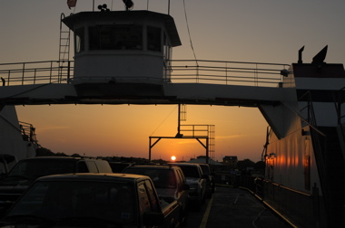
After the beach we took a ranger’s recommendation and hopped the 3-minute ferry across the St John River to Mayport. You can ride over as a passenger for $1.00 or take the car for $3.25, each way. It’s pretty expensive for such a short ride.
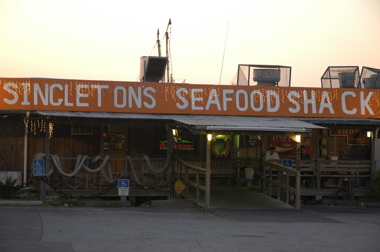
But it’s worth it. A hundred feet from the dock on the Mayport side is Singleton’s Seafood Shack, a family-run institution that has a richly deserved reputation for serving great food. We left absolutely stuffed full of crab, fish, scallops, shrimp, clam strips, collard greens, coleslaw, rice & beans, and hush puppies. This place is highly recommended! The big collection of hand-made wooden boat models in the back room is a free bonus.
We have decided that our Open House/Happy Hour/Meet’n’Greet/Free Snacks events for blog readers and other friends will be next Friday from 1 pm to 2:30 pm, and Saturday 1 pm to 2 pm. We’ll be in site I-46 at Ocean Lakes Family Campground. If I can find a flagpole kit for the Airstream, we’ll be flying the Airstream Life flag. Come on over if you can.
« Previous entries ·
Next entries »


