Archive for Places to go
January 11, 2008 at 8:00 pm · Filed under Places to go, Roadtrips
Quartzsite is working out, so far. There’s not much nightlife, which is to say, there’s virtually none. I’ve been told that some restaurants close down at 7 p.m. because everyone eats early. So last night I hung out at Jim Breitinger’s trailer over in the flea market area. Jim is a full-time Airstreamer who travels around selling meteorites, jewelry, and rocks. (We last saw him in Denver, and previously in Vermont.)
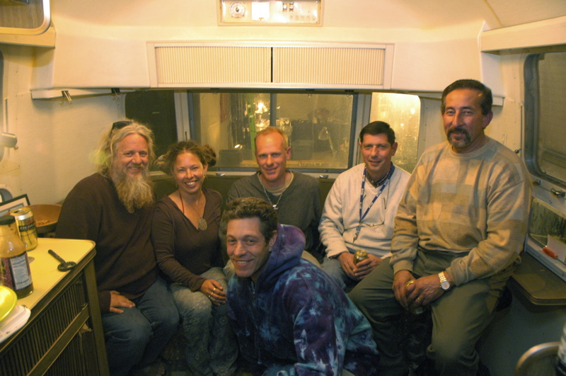
A few of the other rock dealers came over for dinner. On the right in this photo (with the lanyard around his neck) is Jose, who sold Emma a meteorite back in Denver last fall. The people who travel around selling beads, rock, jewelry, gems, and other things always have interesting stories to tell, so it was a pretty lively night.
Sleeping here in La Posa West LTVA was peaceful. The Interstate is less than a mile away, so it can be heard, but not through closed windows. The only real noise was generators running for a couple of hours starting around sunset. The town of Quartzsite is along the north side of I-10, and the largest LTVAs are along the south side, so there’s no city lights or traffic to speak of over here.
One nice thing about boondocking in the desert is that there’s no problem getting a good position for solar gain. The trailer is oriented so that the curbside gets hit squarely with the early morning sun, which warms the trailer in the morning and lessens my need for the furnace. The solar panels really kick in after 9 a.m. and there’s nothing to obstruct getting the maximum gain all day. If my panels tilted I could generate more power than I need, but since they are flat-mounted I can only get about 25 amp-hours per day, which means I need to watch my power consumption (see solar report below).
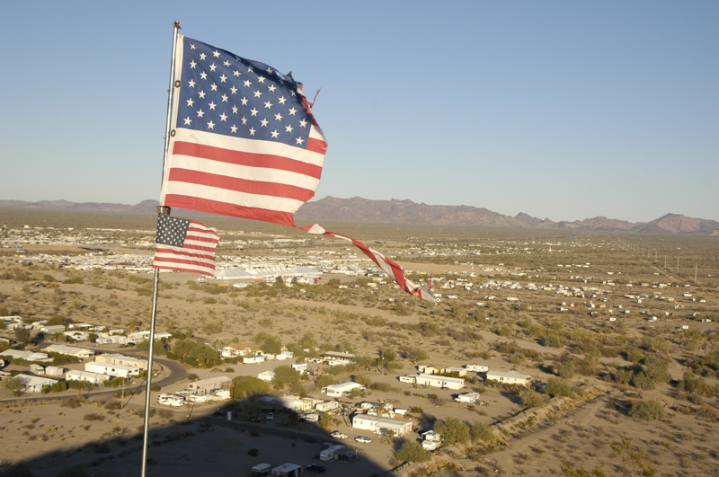
View from Q Mountain. La Posa LTVA to the right.
Near La Posa West and the highway frontage road (Kuehn Rd) is “Q Mountain”. It’s a hill with a giant white “Q” painted on it. You can drive up to the base of the hill if you have 4WD and climb it in about five minutes for a nice view of the area. In the photo above, if you follow the torn scrap of flag straight to the right, you can just barely see a speck of silver. That’s me. (Click on the photo to enlarge it.)
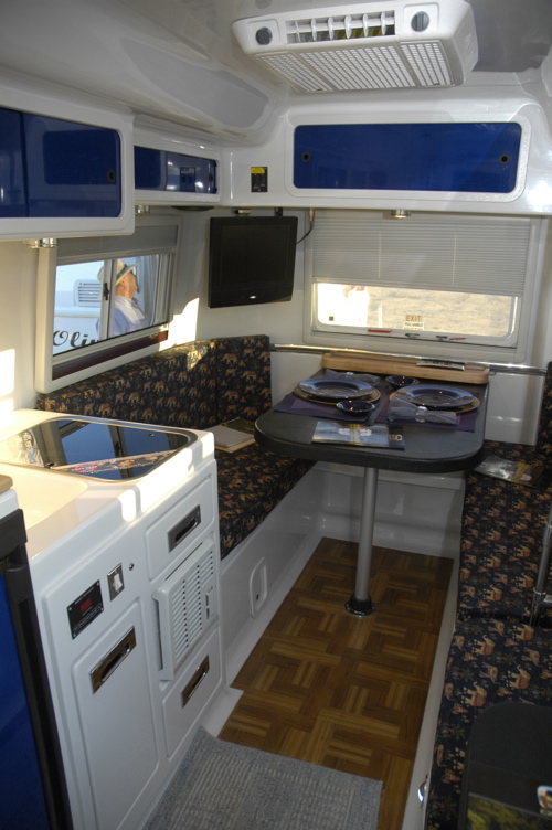 There are tons of RVs being sold here, most of which didn’t interest me. But this one did. It’s a Casita knock-off called an “Oliver“. Actually, calling it a knock-off is somewhat unfair. It’s actually a huge improvement. I toured them and was more impressed with it than any other RV I’ve ever seen (barring Airstreams, of course). It has a double-wall insulated fiberglass shell, aluminum frame, big holding tanks, electric levelers, beautiful appointments, and so many bells & whistles I can’t even list them. They cost almost as much as an equivalent length Airstream at about $26k, but my initial impression was that they are worth the price.
Solar report: at 8 a.m., power consumed was 46 amps. At 4 p.m., solar gained was 25 amps, for a net of -21 amps. Given that I had full sun all day, I now know my daily budget. I did a lot of work on the laptop today, so I’ll have to compensate for that drain by keeping the furnace set low. Last night I kept it at 52 degrees, with an extra blanket on the bed, and was comfortable. I can’t wait to get that catalytic heater installed in March!
December 17, 2007 at 8:03 pm · Filed under Places to go
We went over the park map with a volunteer at the Visitor Center today, and I was amazed to discover how much of Anza-Borrego we’ve managed to explore in our five visits (some prior to owning the Airstream). But one place we’ve never gone to is Coyote Canyon, north of town.
After driving through a couple of miles of grapefruit groves, the paved county road abruptly ends and drops off a foot or so onto a sandy 4WD road. We bounced along five miles of washboard, sandy ditches, and two water crossings before ending up at Lower Willow, at the beginning of Coyote Canyon.
Here the road is gated from June 1 through August to allow the bighorn sheep to drink from the constantly-flowing river. Today the gate was open, leading to a short drive up the river and along a rocky jeep trail. There’s another six miles of trail ahead but we turned around here. It was getting fairly technical.
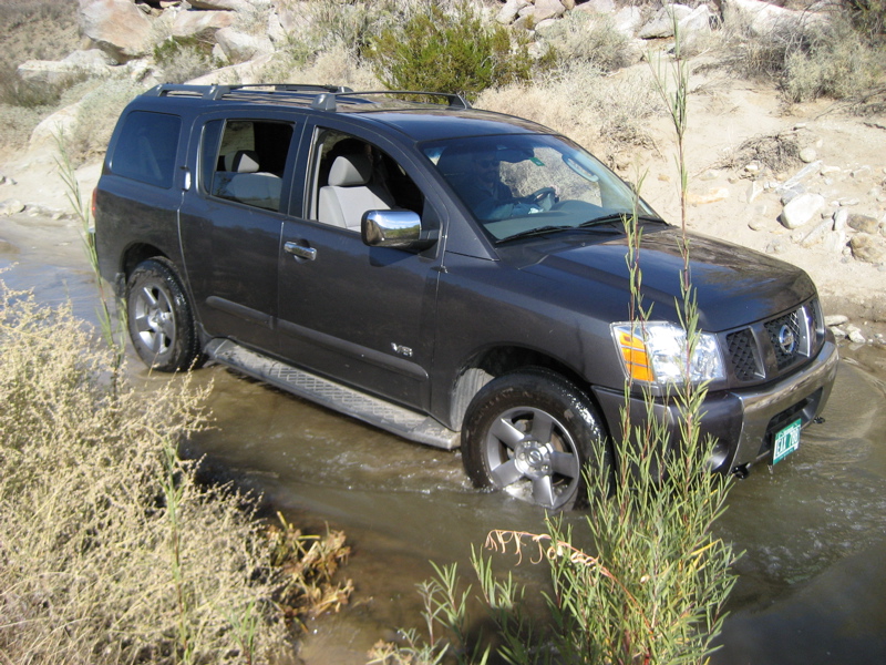
At its deepest the river was only about a foot deep, so our tires got washed but that’s all. Still, it’s always a pleasant surprise to find water flowing in the desert, especially in the dry winter. Further up, we were told later, one ranger got water in her engine at another crossing.
A couple of miles back we stopped at a place called Desert Gardens. There are no gardens here, just an interpretive sign and a couple of picnic tables. This area and north up the river were the year-round residences of five Indian families.
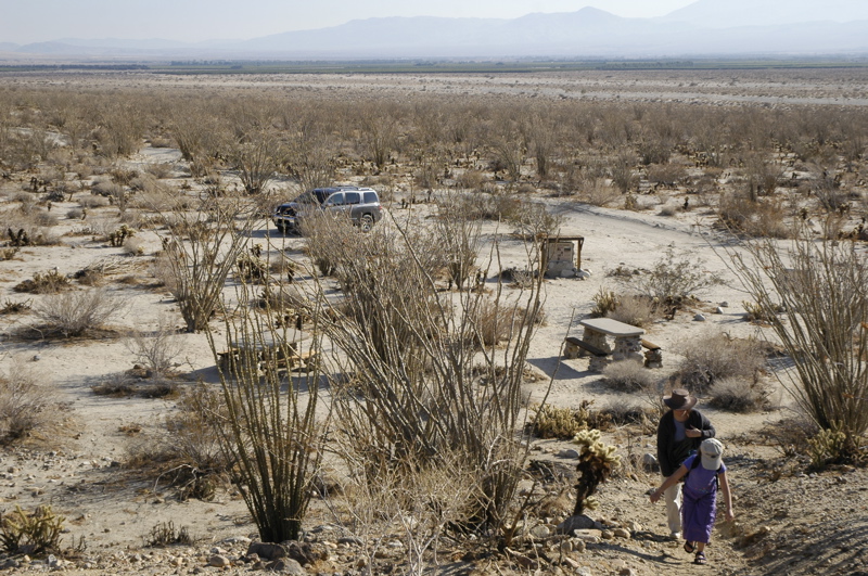
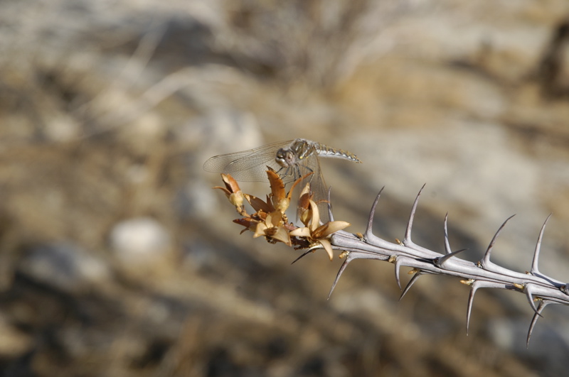
It seems a desolate spot but in fact everything they needed was here to be found, thanks to the river. We hiked a while and spotted a few things: a big-eared Desert Jackrabbit, some ocotillo with small red blooms, a few insects — things like that — but no tarantulas or bighorn sheep, which are what we were really looking for.
December 13, 2007 at 9:55 pm · Filed under Places to go
This morning we hated to leave our little boondocking spot in the desert. We would have stayed another night somewhere out there, but we had reservations for the Palm Canyon campground at Anza-Borrego Desert State Park and it’s one of our favorite spots. None of us wanted to miss a single day of it.
Besides, we had made plans to meet Tommy and Kathy, our friends from the San Diego area. Tommy, as you might recall, has offered to teach me ukulele this weekend. I’ve been practicing chords in the evenings, in an attempt to be prepared for him.
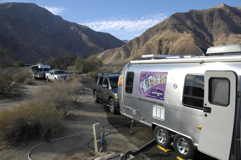
Sometimes it’s nice to be recognizable by our Airstream. In January 2006 when we were at Anza-Borrego, Eleanor made friends with a ranger and promised to bring her maple syrup on our next visit. Last March when we returned, the ranger spotted Eleanor and said, “You promised to bring me maple syrup.” Eleanor reached into the back of the car and handed her a quart on the spot. (Yes, we used to travel with maple syrup. We are, after all, from Vermont.)
This time when we rolled in the ranger said, “Luhr, right? Your friends are already here and they’re going to save you a spot. Just go right in and let me know where you’ve parked later.” So we found Tommy and Kathy and got set up, and not long after Tommy was in the trailer trying out my new Kala tenor ukulele.
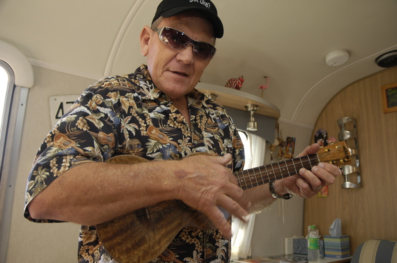
This evening Tommy made a fire and set up his gear. He came ready for serious jamming, with three ukes of his own (Martin soprano, Martin tenor, and a uke banjo with hubcap resonator), his music stand, two big binders of songs, plus a CD and some sheet music for me.
Those nights of practice paid off. He gave me some tips, taught me a few more chords, and it wasn’t long before we were playing songs together. I’m far from proficient (and not ready for public performances!) but it was a really great experience to go from bumbling and unable to play a song, to able to play a song while bumbling.
Tonight is the classic winter night in Anza-Borrego. The sky is crystal clear and the stars are glowing, the coyotes are yip-yipping off in the darkness, and there’s a sense of wonderful desert peace. We are so grateful to be here. I wish we could stay for a month.
December 9, 2007 at 11:29 pm · Filed under Places to go
There really is nothing like Las Vegas. Love it or hate it, it’s unique. And since Brian and Leigh haven’t kicked us out yet, we finally got a chance to go scout around town with them today.
Our first stop was the Las Vegas sign on Las Vegas Boulevard at the north end of The Strip. Leigh is building a collection of photos of everyone who has stayed overnight at their house. Each visitor is posed in front of the Las Vegas sign. I’ve been wanting to be the subject of one of those photos ever since I saw the first one on their blog months ago. The sign is a popular spot, despite being located in the median strip of a busy road. There’s always someone there getting their picture taken. So now we are part of our hosts’ permanent history.
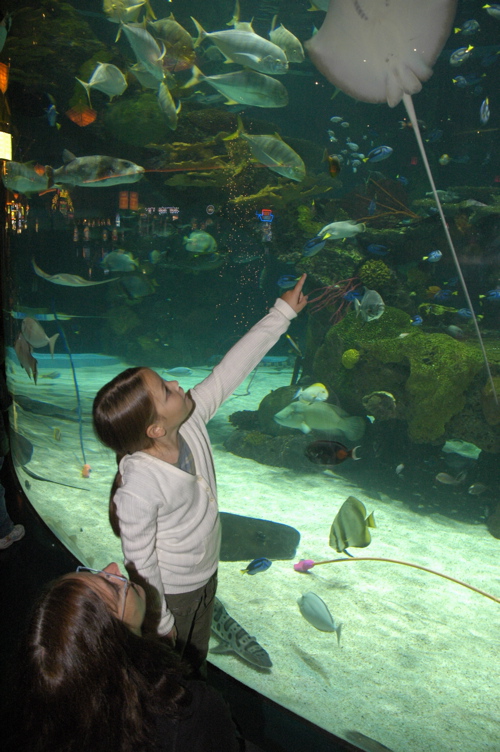
Now, we’ve all seen the mammoth Bass Pro Shops, but of course the Las Vegas one has to be bigger and better than all the rest. The one we visited featured an enormous salt water aquarium, in addition to a casino, a bowling alley made to look like a very long Airstream, and a hotel. It’s all free to roam, which reminds me that there are a lot of great things to see and do in Las Vegas that won’t break the bank.
The Airstream bowling alley is only two lanes and kids aren’t allowed inside. But it turns out we all like bowling so we headed over to a different casino with about 70 lanes. (There doesn’t seem to be any bowling in Las Vegas that isn’t attached to a casino.)
At sunset we went to the Ethel M Chocolate Factory and Cactus Gardens. (That’s the weirdest combo since the Hawaiian Nuts and Ukulele Company last week.) At Christmas time the cacti are covered in colored lights and the effect is ethereal, even spooky. This gives me ideas for our future Christmases in the desert. A saguaro in the backyard makes a very interesting Christmas tree.
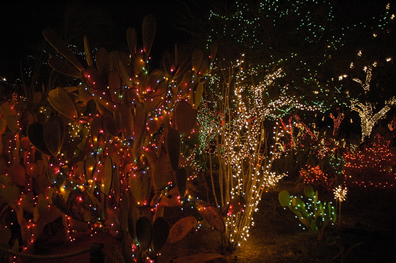
Then of course we had to take the chocolate factory tour (free & quite brief), and ended up in the chocolate store. So some people we know are going to get some very nice chocolates for Christmas.
We really have to leave Las Vegas now, or at least the driveway. We still haven’t been kicked out officially, but our holding tank is full. I think that’s a sign we’ve taken sufficient advantage of the hospitality. We’ll hit the road in the morning, due south, and see what’s interesting between here and Mexico.
November 26, 2007 at 11:40 am · Filed under Places to go
At 3:10 a.m. last night a strange dream startled me awake. I noticed that the entry light in the hotel room was left on, so I got up to turn it off and stepped into a puddle of water. Water was dripping from the illuminated ceiling light onto the tile floor.
My laptop was sitting on the floor just a few feet from this event, being recharged at the only available plug in the room, and it was splashed with water, but fortunately only on the top. The keyboard and the rest of the case were dry. I rescued it and grabbed the ice bucket to catch the dripping water, and then called the hotel’s Front Desk.
By 3:30 or so the Mystery of the Dripping Light Fixture was solved: the central air conditioning unit’s drain had apparently failed and the ceiling above our entryway was flooded. We shut off the A/C, laid out some towels, and went back to bed.
That is, until 5 a.m. when Emma awoke us to announce that the front right bicuspid that had been bothering her for the past week had finally come out. Eleanor decided that the tooth fairy was already on her way home for the evening, and it was agreed that the tooth would have to wait for the next night.
So it wasn’t a highly restful night. At 8 a.m. we got up and began packing up the room to move to another room. Between packing, waiting for housekeeping to get another room ready, and unpacking, we lost most of the morning. I would like to say that the hotel was exemplary about this situation, but they weren’t. The Front Desk staff was unapologetic and we ended up in an identical room with no offer of an upgrade or any conciliatory action for the wasted morning.
But this is not highly surprising. The hotel is tired. Basic maintenance is done but the little signs of long-term decay are everywhere here. The beds are saggy, the drawers are malfunctioning, the carpets are overdue for replacement, the bathroom hot water tap doesn’t reliably shut off, the A/C thermostat doesn’t work, and a couple of fluorescent bulbs never would light fully. On the surface the hotel appears nice enough, with very nice landscaping and a spectacular setting with panoramic views, but at its core it is a grade B tourist hotel with decaying infrastructure.
[Followup 11-29-2007]: [On checkout Eleanor spoke to the new hotel manager about the problems we had. He listened, was sympathetic, and spoke honestly about the problems the hotel has. He’s been trying to turn the place around since he took over four months ago. By way of apology he comp’d one of our meals and spent about fifteen minutes with Eleanor discussing what he plans to do to improve things. We were reasonably impressed and hope that in the future the hotel will do better under his good leadership.]
This gave me occasion to compare disappointing places we’ve encountered with the Airstream to this experience. We’ve had some really bad campgrounds, but since we tow our “hotel room” around with us, at least we have control of our immediate surroundings, and since they are mobile we can easily move to a better location as needed. We also maintain our Airstream better than this hotel does its rooms.
Since we usually don’t spend much time in a hotel room, it’s not normally something we think about. Today would have been same if we had been able to get up and go out for the day as we were expecting. Only the fact that we were trapped here most of the morning has forced us to look at the room and the hotel more critically, and see the faults of the place.
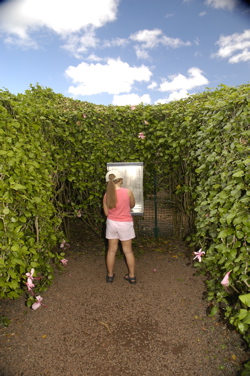 With less than a full day to play with, we opted to do tourist things rather than go for a full day of snorkeling. On the way to the North Shore we stopped at the Dole Plantation and ran through the World’s Largest Maze to find eight secret stations. This was undoubtedly Emma’s favorite part of the day, although the pineapple sherbert was probably right up there.
The North Shore is a great part of Oahu. It’s known for big surf, especially in winter, but we found a couple of very nice sheltered snorkeling spots too. Right now a big surfing competition is going on, at least on days when the surf is high.
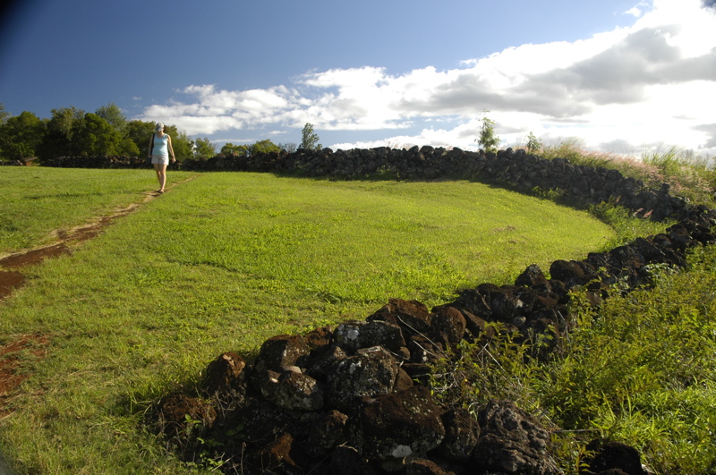
A right turn off the main road leads up a switchback road to the most intact heiau in Hawaii. It’s now a state monument, called Pu’u O Mahuka Heiau. The heiau is a historic and religious site, and you have to treat it with respect. Because the visible site at first appears to be just a bunch of lava rocks in a field, it takes a little imagination to appreciate what this site represents.
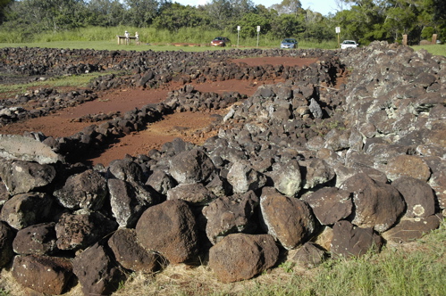
Imagine in the 1800s, you are a British sailor who has landed at Oahu and is going ashore to find fresh water. You and your fellows are captured by the mu, who hauls you up to the stony heiau to face kahuna (high priest) Ka’opulupulu. As part of a ceremony designed to ensure success in war, you are sacrificed at the luakini altar.
Suddenly that pile of rocks is a lot more meaningful, isn’t it? And now, the minor discomforts of a less-than-wonderful hotel aren’t nearly as bothersome. I mean, hey, we’re not being killed here.
The rest of the day (roaming through town, checking out beaches, buying flavored shave ice) was fine, but I’ll always remember the heiau. To me, that’s Hawaii.
November 14, 2007 at 9:10 pm · Filed under Places to go
During our stay in Visalia, Roger mentioned a few places to camp in Paso Robles and Pismo Beach. I was considering them all until he mentioned that in Pismo Beach, if we drove past the commercial campgrounds and the state beach campground, we could camp on the beach. That was all it took to make the decision.
We’ve camped at the beach several times, and we always like it. Memorable places include Charlestown State Breachway (RI), the Red Coconut (Ft Myers FL), and Bahia Honda State Park (Florida Keys). We’ve also driven on beaches, including a couple of weeks ago in Oregon and back east in St Augustine FL. But we’ve never camped on the beach before.
It’s a three hour drive across the sunny dry valley on Route 41 to get to Hwy 101 and finally Rt 1 along the coast. But then when you swing through Pismo’s downtown and see the surfboard shops, Chinese restaurants, art galleries and, just beyond, palm trees in sand, suddenly the sun is a welcoming friend and the drive is worth it.
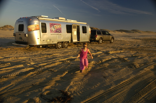
The camping here is just $10 per night, since there are no amenities except trash barrels and chemical toilets. Most of the dozen or so campers here have brought four-wheelers and buggies to ride in the dunes behind us. They’re here for the long haul, so a truck comes by daily selling ice. The truck also pumps out holding tanks. I hope they keep the two operations well separated.
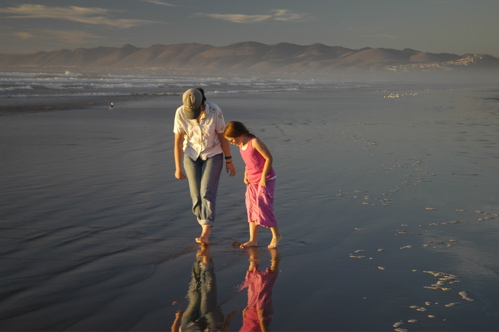
We got here about 4 p.m. but this time of year that means only about 90 minutes until sunset. Now at 6 p.m. it is utterly black outside except for the stars, the crescent moon sitting low over the Pacific, and a glowing line to the north from the town of Pismo Beach.
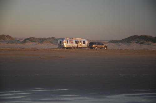
I have to admit to a little trepidation about the softness of the sand. The lady at the entrance booth who took our $10 told me the times of high and low tide, advised me to be sure to tow the trailer on the wet packed sand but park above the high tide line. The thought had occurred to me already, when I was first contemplating towing an 8000 lb trailer on the beach. The trailer sinks into the sand about half an inch in most places, a little deeper sometimes. To be on the safe side I kept the speed up to the maximum of 15 MPH and the 4WD engaged.
The trick is that above the high tide line the sand gets soft, so like all the other RVs we are straddling the uppermost line of packed sand and hoping not to get wet. We don’t have floats like Chitty-Chitty Bang Bang. We’ll be watching the tide come up tomorrow at noon. In the meantime, the pounding of the Pacific surf outside our window is a constant reminder of the sea just outside our aluminum walls.
November 9, 2007 at 6:34 pm · Filed under Places to go
I’ve been looking at the maps for Yosemite and realizing that the convoluted nature of the roads means it can be a very long drive to go a very short distance (as the crow flies). From our campsite, we can look up and see a sheer cliff of granite, above which is Glacier Point. Glacier Point is a spectacular place to view the entire Yosemite Valley and I wanted to go there.

It would be simple to get to Glacier Point if you had a helicopter. It is 3,200 feet above us and perhaps a half mile to the southwest. Not far at all. But that’s like saying outer space isn’t very far. After all, it’s only an hour’s drive away if your car can go straight up.
For us earth-bound residents, there are two ways to get to Glacier Point. You can hike the “Four Mile Trail” which zig-zags steeply up the mountainside. This was the historical route for early visitors to the valley, and it’s climbing all the way. I would expect it to take us about eight hours to get up that route.
The other method is to drive out of the valley on Route 41, climbing steadily and winding constantly, until you reach the Glacier Point Road on the left. Then keep climbing and twisting until at last you reach Glacier Point. It’s about 25 miles and takes 45 minutes to drive. Once you’ve completed the drive, you are almost exactly where you started, except 3,200 feet higher and lightened by a couple of gallons of fuel (which currently costs $3.77 per gallon at Wawona, by the way). It felt faintly ridiculous to have done all that driving to end up where we started, but the view from Glacier Point made it all worthwhile.
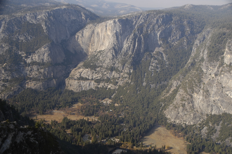
There are four managed burns going on in the park right now, which occasionally send layers of brownish smoke through the valley and obstruct the view, but we found that over the course of the day the view clears. Even with a light haze and occasional smoke, the viewing was superb. The valley is laid out before you like a model train set. We could see almost everything, including our Airstream, glinting through a gap in the trees.

While we were up around 7000 feet, we stopped off to hike to Sentinel Dome, which is another great viewing spot. That’s a relatively easy 2.2 mile roundtrip, even in the thin air of 7,000 feet, is worth doing if you are passing by on Glacier Point Road.
 The next stop was near the southern entrance of the park at Wawona, the Mariposa Grove of Giant Sequoia trees. These trees are absolutely incredible. The Pacific Coast Redwoods are magnificent and humbling as they tower in the fog, but the Giant Sequoias (close relatives) are just plain huge. They aren’t taller than the Coast Redwoods but they are bigger in diameter, and that has a tremendous impact on how you perceive them from the ground. Even a fallen Sequoia lying on its side will tower over a human. They are the largest living things on earth, and also the longest-lived (up to 3,000 years old). The Grizzly Giant in the photo is estimated at 1,790 years old. It’s worth the trip to visit the Sequoias, even if it means 25 miles of hairpins curves on Route 41.
This time of year the light fades early behind the mountains, and by 4:30 the Sequoia grove was getting too dim for photography. We hustled back to the cars and found ourselves driving back in the dark at 5:15. On the mountain tops we could see the prescribed forest fires glowing like lava on a volcano.
Back on the hotel’s wifi I reviewed the weather for the next few days and it looks like Sunday will bring some rain. We were thinking we’d head out on Saturday anyway, and the weather report solidified the decision. It is also going to get colder in Yosemite next week, possibly with a little snow overnight. We made the right choice zipping down through northern California to get here before the weather started to change. Now, it’s time to get back to the valley for a week of work, repairs, maintenance, and planning of the next trips.
« Previous entries ·
Next entries »
 There are tons of RVs being sold here, most of which didn’t interest me. But this one did. It’s a Casita knock-off called an “Oliver“. Actually, calling it a knock-off is somewhat unfair. It’s actually a huge improvement. I toured them and was more impressed with it than any other RV I’ve ever seen (barring Airstreams, of course). It has a double-wall insulated fiberglass shell, aluminum frame, big holding tanks, electric levelers, beautiful appointments, and so many bells & whistles I can’t even list them. They cost almost as much as an equivalent length Airstream at about $26k, but my initial impression was that they are worth the price.


