October 4, 2008 at 6:10 pm · Filed under Places to go
Yesterday we met with 28 other Airstreams at the Camping World on I-40, and the entire line of aluminum caravanned together to the Balloon Fiesta Park on the north side of Albuquerque. From a gravel lot overlooking the Balloon Fiesta field, we will spend four nights watching all things related to hot-air and gas ballooning going on. This is our final blowout adventure of this season of travel.
The danger of attending the famous Albuquerque Balloon Festival is that you’ll take too many photographs. Actually, it’s inevitable. The balloons are so colorful and scenic that you can’t stop at, say, 100 photos. I got up in the 5 a.m. darkness to scout a location for photos of the “Dawn Patrol,” and by 8 a.m. I had filled a memory card with over 300 photos. Don’t worry, you don’t have to look at all of them. You can see some of them on Flickr by clicking here.
This is also an event designed to mess with your Circadian sleep cycle. Everything happens between 5:45 a.m. and 8:30 a.m., then again from about 6 p.m. to 9 p.m., when the winds are light. In between, there’s little to see except the long row of merchants, arranged like a county fair, that runs next to the balloon launching field. If you try to be awake for everything, like we are doing, it means a nap in the afternoon is a really good idea. Normally that would work for me, but with all the socializing going on, I haven’t been successful today.
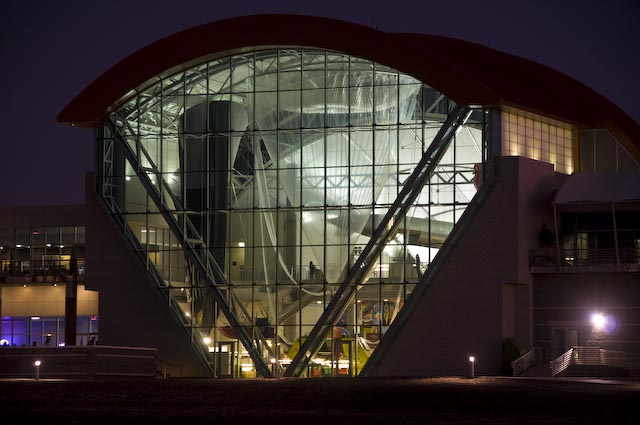
Balloon Museum, by Bill Ferry
The other hazard to successful sleep is generators. We are parked in tight rows. Behind us is a row of Country Coach motorhomes. In front of us are three rows of Prevost bus-based motorhomes ($1 million and up each). All of these motorhomes have diesel generators built into them, and the Balloon Fiesta allows very liberal generator hours, from 5 a.m. to 10:30 p.m. Even though those diesel generators are pretty quiet, we can hear them running for hours on end, and the fumes of diesel can be intense. We have to sleep with the windows and vents shut completely.
Emma linked up with Olivia, a 5-year-old girl who is the only other kid in our group. The two of them spent the afternoon building a robot (named “Rusty Sprockets”) from paper, and then running the classic lemonade stand next to Olivia’s trailer. They cashed in to the tune of several bucks and so tomorrow they want to try selling popcorn instead.
I’ve been surprised at the number of people here who say they’ve been following our blog. There seem to be many people reading it who prefer to remain anonymous. That’s fine, but it makes me wonder what I will do to stay in touch after next week, when this blog will end. It’s a subject of much debate in my mind right now.
Tonight the schedule calls for another balloon launch and some fireworks. The wind has picked up and the forecast is for rain tonight, so I doubt we will see any balloons taking off, but there will likely be a “balloon glow” at least. We may stay in and get to bed early. Tomorrow the schedule repeats, starting once again with 5:45 a.m. for those who care to get up. Those who don’t care to get up will be up anyway, around the same time, when the generators all fire up to run coffeepots in the morning. So I have a feeling we’ll all be ready to hit the sack by 9 p.m.
October 3, 2008 at 10:40 am · Filed under Uncategorized
We’re heading out this morning to the Albuquerque Balloon Fiesta!
Yesterday we took a daytrip to El Malpais National Monument and El Morro National Monument, both of which are about 30-40 miles south of Grants. El Malpais is a large area of volcanic origin, with lava tube caves, cinder cones, craters, and other features that are fun to hike around. A chat with the ranger on duty, and a three-mile hike gave us a nice overview of the park’s major features.
El Morro is only 18 miles away but entirely different. It is much smaller, comprised of a bluff of very soft sandstone and a permanent pool of water that was a popular stop for native Americans, Spanish explorers, and settlers during the western expansion. “Inscription rock” holds most of their signatures, petroglyphs, and graffiti. The oldest European signature dates to 1605, but there are even old Puebloan petroglyphs that of course have no dates
I’ll get pictures up later, but right now we are rushing to get out of Grants in time to drive to Albuquerque and meet the other 29 Airstreams for a caravan into the Fiesta grounds. We’ll be parked right next to the balloon launching field for the next four nights. You can expect a lot of photographs soon.
October 2, 2008 at 11:46 am · Filed under FAQs
Our great Four Corners circle tour is coming to an end. Over the past month we’ve wandered from Great Sand Dunes NP to Silverton CO, Mesa Verde NP, Hovenweep, Natural Bridges, Capitol Reef, Bryce Canyon, Kanab, Grand Canyon, Page AZ, Navajo Nat’l Mon., Canyon de Chelly, and finally here to Grants, New Mexico. That’s in addition to minor excursions to Pipe Springs Nat’l Mon., Glen Canyon NRA, Grand-Staircase Escalante, Vermillion Cliffs, Navajo Bridge, and (on Monday), Hubble Trading Post Nat’l Mon.
All told, we’ve driven about 1,300 miles since the last oil change in Cortez, CO on September 2. Since then we’ve visited 15 national park sites, camped for a month in some spectacular locations, and had a really terrific time. Since we never drove more than 100 miles on any towing day, and because we were careful about where we camped, our costs were ridiculously low. We spent a total of $500 on gas, and $471 on camping — for a month!
That means our daily cost for camping and fuel to explore the Four Corners was about $32 per day. All of our other expenses were the same ones we’d incur at home (groceries, etc). That’s a serious bargain.
Now, it has not escaped anyone’s attention that the economy is struggling. The RV industry is being hit particularly hard, by the dual whammies of higher fuel prices and tight credit. The manufacturers of behemoth fifth-wheels and expensive Class A motorhomes are getting hit the hardest. The word on the street is that “the price of gas has made RV’ing too expensive.”
Nonsense. We just demonstrated how incredibly affordable it can be. If we’d been like the non-RV tourists who packed into buses or rented cars at Grand Canyon and Bryce Canyon, and who stayed in the expensive lodges, we’d have spent our entire budget in a week.
The trick is to stop driving around so much. A lot of people who have bought RVs in the past have a tendency to log miles instead of days. If you’re going to drive 1,000 miles a week, you’re going to expend a lot of your budget on fuel. Sometimes that’s unavoidable, but fortunately there’s a lot of stuff to do and see in this country without going too far. You don’t have to go to Alaska to have a great adventure. We’ve visited most of the 50 states in our travels and there isn’t one state in this great country that doesn’t have fun and interesting things to do.
In other words, instead of point-to-point roadtrips of the classic style (drive 1,500 miles to the destination, spend four days there, then drive 1,500 miles back), the secret is in picking a specific region and exploring it. By focusing on the Four Corners region and hopping slowly from park to park, we were able to keep our mileage to an average of 43 miles per day.
A few weeks ago when I was being interviewed by a L.A. Times reporter for an article about RV’ing, he argued that my claim of economy was invalid because it didn’t include the cost of ownership. He figured that a travel trailer sitting in the garage at (for example), $477 per month made the true cost of an Airstream trip much higher. (I’ve figured a $50,000 loan on a travel trailer for 15 years at 8.0%. That would get you a heck of a nice Airstream.) The reporter was correct if you leave your rig in the garage most of the time and only take it out for two weeks a year.
But how much of a premium are you really paying even in that “worst-case” example? A year of payments would be $5,724. Add in insurance, a little maintenance, and even some storage fees, and maybe you’re up to $7,000. Now, go take a two week trip and spend $500 on fuel and $350 on camping (full hookups every night!) Your trip just cost you a total of $7,850, and for that you paid for the trailer for a year. No question, that’s expensive.
Now go price a two-week trip for a family of three to any popular destination in North America. Add in airfares for everyone, hotels for 14 nights, rental cars, tips, 42 restaurant meals for three people, rental car fuel, excess baggage fees, etc. That’s about $5,000. That’s expensive too, and we’re close to paying for the Airstream already.
Take just one more week-long trip with your family, and you’ve paid for that travel trailer for the year. Not only that, but you didn’t have to go through security checkpoints, sleep in unfamiliar beds, tip bellhops, live out of a suitcase, comply with a rigid schedule of hotel reservations or tour schedules, etc. It’s still a no-brainer from my perspective.
The real economy of this form of travel is for people who have lots of time and want to explore North America. If you take just one week of vacation a year, or you prefer your vacations to be spent in Paris, an RV is probably not for you. But if you like to take lots of road trips, it’s still a great way to go — even with gas prices. We’re certainly happy with our $971 month-long trip through the Four Corners.
September 29, 2008 at 10:04 am · Filed under Uncategorized
 In the interest of exploring further the mysteries of Canyon de Chelly, we got up before dawn for a ranger-led hike down the Tunnel Trail. Normally the trailhead is gated and locked, so the only way to hike it is with a guide or ranger. It’s an easy hike into the canyon, about 300 feet of total descent/ascent, with a short steep section.
About 80 families live in the canyon, according to our ranger (who is herself Navajo and a resident of the canyon). They live seasonally, farming in the summer and heading up to the mesa or into the town of Chinle during winter because ice and snow in the canyon can be a problem. Although guidebooks like to portray the Navajo of Canyon de Chelly as “living in the historical past” and imply that they are like Amish and eschew modern conveniences, it’s really not true. They run tours and travel through the canyon in late-model pickup trucks. They are educated people, attending the K-12 school in Chinle and in many cases going on to college, as our ranger did. They speak English as well as Navajo.
 But on the other hand, in the canyon they tend to live agricultural lives, raising sheep and corn, living without TV (there’s no usable signal in the canyon), and relying on generators for electricity. The really obvious difference, to me, was that the Navajo have lived in this canyon for hundreds of years, and in all that time they have respected the many ruins, human remains, petroglyphs, and pictographs left behind by the Ancient Puebloans (Anasazi) so that all of those things are still right out in the open to be seen by tourists today. The Navajo regard all of those remnants of their ancestors as being protected, not by National Park Service rules, but simply out of respect for those who have been here before.
 We hiked through the sandy wash that runs through the canyon for about a mile to reach “First Ruin,” another good cliff dwelling site located high above the canyon floor. There is an ongoing debate about the reason the Ancient Puebloans lived in cliff dwellings, and why they suddenly abandoned them around A.D. 1300. From listening to rangers at Mesa Verde, Hovenweep, Natural Bridges, Capitol Reef, Grand Canyon, Navajo, and now Canyon de Chelly, I can assure you that the debate is far from over. The theory that these were defensive structures seems to be dying out because nobody can find evidence of violence. Same with the theory that invaders drove out the residents. The top theories we’ve heard are: extended drought (supported by tree-ring analysis, or “dendochronology”), crop failure due to over-farming, normal migratory patterns, and “who the heck knows?”

 Our second stop on the hike was “Newspaper Rock,” so-named because it was a place where later natives, including Navajo, Hopi, Zuni, and other tribes, stopped to write messages in petroglyphs. The variety of petroglyphs here is amazing, and with a guide to rock art symbols (obtainable at most visitor centers) you can take a guess at what some of the messages mean. Often over the cliff dwellings there are clan symbols, but at Newspaper Rock there are no dwelling ruins, so it seems to be just a place to post a message.

At the end of the hike, the oldest person on the hike (age 76) asked for a picture of herself with the youngest person on the hike (age 8). Our ranger, Geri, also joined in — and of course, Zoe the cat who goes on all hikes.
Our exploration of the canyon lasted for several hours, so once again we really felt like we’d gotten a great ranger tour. Unfortunately, when we returned Eleanor opened her bag and realized she dropped a plastic sleeve containing her driver’s license, three credit cards, a few less important cards, and $70 in cash. This wasn’t discovered until we had returned to the Airstream later in the afternoon. We searched the car, the Airstream, and tried the visitor center’s lost-and-found, but she concluded it was lost in the Canyon de Chelly wash. We shut down all the cards with three quick phone calls, and then in the middle of the night she woke up and remembered where they were. Too late — new ones are on the way. But at least she didn’t lose the $70, and our plastic is not littering the bottom of a National Monument.
There is currently some discussion about whether the Navajo should reclaim the canyon from the Park Service and run it themselves. They have that right, under an agreement struck in 1931 when the park was first opened. Most people (including Navajo) seem to feel that the Park Service has done a good job at protecting, interpreting, and managing the canyon. It has a good visitor center, cooperates well with the locals, maintains the infrastructure (campground, roads, trails, signs, fences), provides law enforcement, promotes the canyon nationally, etc.
If the Navajo run it as a tribal park (as is done with Monument Valley), it’s not clear what will happen to it. Right now everything is free, supported by the National Park Service’s funding. I would expect that fees would be instituted for everything, including guided hikes, camping, and the visitor center. It would also likely be struck from the NPS list of parks, which might reduce visitation. From what I’ve heard, reducing visitation is not the goal of the proposal.
There was an open forum for the Navajo in the campground amphitheater yesterday afternoon on the subject, but since we were busy looking for credit cards, we couldn’t go. I’ll be interested to see if the idea goes further.
A few weeks ago I was thinking that we had excess time in the schedule before going to the Balloon Festival, but now time has run short on us. We need to meet everyone for a caravan into the Balloon Festival on Friday, and between now and then we wanted to visit several more parks in New Mexico. Chaco Canyon will have to be skipped this time, and we may also miss Petroglyph National Monument. This week I have to be in locations where I can make reliable cell phone calls, which may even make it impossible to visit El Morro and El Malpais National Monuments. Plus, on Thursday night we need to be somewhere with a dump station, so we can arrive at the Balloon Festival with empty holding tanks. That rules out some interesting boondocking possibilities I would have explored later in the week.
We don’t have a firm plan, as usual. We’ll wing it this week with a combination of whatever works. We are in our last two weeks of full-timing, and there’s no point in getting rigid about the schedule now, after three and a half years.
September 28, 2008 at 9:00 am · Filed under Places to go
This national park is very different from the others. There are people living in it. The national monument, which is made up of both Canyon de Chelly (pronounced, “shay”) and Canyon del Muerto, is the home of Navajo people who continue to live and farm traditionally. As long as they are there “” and they have no plan to leave “” the Anglos who come to see the monument are required to observe the canyon from the rim. We are not allowed to enter the canyons without a Navajo guide, either by foot or by car.
We’re also asked not to photograph the Navajos, their animals, or their homes. After all, they are real people who want privacy. So there are two primary places that most people go when visiting this national monument. They drive the North Rim and stop at one of four overlooks, and they drive the South Rim and stop at the other seven overlooks. From these overlooks you can see the deep walls of the canyon, cultivated fields, sandy primitive roads, an occasional house, and a couple of cliff dwelling ruins. It looks idyllic from above, and all the more interesting for being prohibited to non-Navajos.

 Everyone wants to get down to the bottom, but there is only one hike that you can do in the park without a Navajo guide or a park ranger. The White House trail steeply winds all the way down to the canyon floor and ends at the well-preserved White House Ruin (2.5 miles roundtrip, 500 ft elev. change). It’s a beautiful hike, which we did yesterday.
In fact, the whole canyon is stunningly beautiful. Unlike most other Four Corners canyons, this one is lush and green, with a flat bottom and homes situated through it. The walls are sheer and tall, like in Zion National Park, covered with natural varnish, and fanciful spires and pinnacles of rock decorate the edges. I’ve uploaded many more pictures to my Flickr album.
There’s one other hike, led by a ranger down the Tunnel Trail. We have signed up to take it this morning. It leaves at 7:30 a.m., which makes sense because each day it has gotten somewhat warm and thunderstorms seem to be the pattern in the afternoon. We’re going because (a) it’s the only other hike available; (b) we’ll get some interpretation by the ranger along the way, and probably learn something. At the amphitheater ranger talk last night, we met the ranger who will be guiding us down the trail and she is promising some very interesting sights.
The other option for getting into the canyon is to take a Jeep tour, or hire a Navajo guide to ride with you in your own car (4WD, high clearance required). The visitor center staff does this for you. The cost is $15 per hour (3 hour minimum) for the Navajo guide. We seriously considered it, but after having been in the canyon today and having another chance at a different part of the canyon tomorrow, we probably will skip a third opportunity. We’ll decide that tomorrow.
September 27, 2008 at 10:43 am · Filed under Roadtrips
“There’s not much there,” I was told about the Navajo country, by somebody in Utah. That’s true in the sense that there is little in the way of tourist traps, adventure tours, and shopping malls. But as it turns out, the absence of “things” is part of the interest of the area. There are fewer signs of man, which makes the ones you do see more obvious.
The Navajo Nation is a study in the collision between traditional and modern life, and so almost every little thing tells a story. Little hogans (traditional round houses) sitting next to 20th century mobile homes are everywhere. Everyone drives pickup trucks, but horses roam free by the roadside. In canyons people live by traditional means, but just above them on the mesa their neighbors have a satellite TV.
Across from the entrance road to Navajo National Monument is a coal mine, which pumps out coal from the Black Mesa to feed the Navajo Generating Station in Page, 80 miles away by electric train. The power station eats 1,000 tons an hour of coal, and it all comes from the mine near Shonto, in the heart of Navajo country.
 Driving east on Rt 160 from Navajo National Monument, you soon come to a turn in the road where you must decide if you are heading north to the famed Monument Valley (setting of many a western) and into Utah, or continuing south-east to Canyon de Chelly. Since we started our great circle tour of national parks up at the intersection of the Four Corners, and are heading to Albuquerque, our choice was obvious.
The ride, along Rt 160 and Rt 59 is stark but beautiful. It is designed to bore children and people who are mostly interested in their next shopping opportunity, but we liked it just fine. We stopped in the small town of Many Farms at the intersection of Rt 59 and 160, and caught up on our laundry at the combination gas station/convenience store/ laundromat.
This was really the first time we’d been among the local people in a normal setting. I don’t count the interactions with weavers and painters at the national monument, because they are sort of “on show.” There’s nothing like a laundromat to bring everyone to the same level: we’re all just there washing our clothes, being regular people. Like many towns, the people we encountered ran the gamut.
A panhandler knocked on the door of the Airstream looking for a dollar, while we were getting the laundry together. From his eyes and general appearance I would have to say he was an alcoholic. In the parking lot a crew of two was working hard on some maintenance task, in the convenience store a steady stream of people came and went (including Navajo, white missionaries in ties, and traveling businessmen from outside the reservation), and in the laundry young women were tending to their laundry with toddlers running around their feet. In short, it was just a slice of modern life.
I may have been looking for something else, but really, at laundromat sitting at the intersection of two highways, there’s not much else you could expect. The inner workings of the Navajo community aren’t on display everywhere. So for a glimpse into the community, I bought the local paper (Navajo Times) and read that while the laundry spun.
The Navajo Times is surprisingly well-written, for what I would guess is a relatively small-circulation publication. I’m used to local newspapers being total rags, filled with generic wire stories and relatively little local news. What there is of local news is usually badly written by underpaid recent college graduates. The Navajo Times exceeded my expectations. It appears to hire reporters who actually do their research and write readable articles.
The subject matter, however, was discouraging. Of the lead articles, most were related to various people attempting to scam others. A real estate agent from out of state, already arraigned in court in Montana on bad-check and fraud charges, showed up in the community of Teec Nos Pos and scammed locals with promises of a resort development. The Speaker of the Nation is embroiled in a scandal with an architect who says he was cheated out of $250k in fees “” it’s not clear who is scamming who. A local woman who donated land to the airport now says the town has taken more of her land than she agreed to “” she doesn’t read or write but somehow managed to sign a contract. It all sounds like history repeating itself. Battles over land and money continue.
It’s not far from Many Farms to Chinle, the town that forms the gateway to Canyon de Chelly. We pulled into the national park campground, called Cottonwood in the early afternoon (carrying lots of fresh laundry at last) and settled into a site that has good sun coverage most of the day. We’ve been running on solar power since a week ago Thursday, with great success, and we don’t expect to see a power outlet until at least Monday.
There is cell phone coverage in the area of the campground and visitor center, but it is an independent operator and so for most people calls will incur “roaming” rates. We won’t be making any calls in the next couple of days. We also found a pleasant surprise: the Thunderbird Motel, which borders the campground, provides free wi-fi. We can pick up the signal from the Airstream since we are parked very close to the motel, so once again I can keep the blog updated in a place where I felt I would have no chance of getting online. Today we will do some exploring of the canyon, and I’ll tell you about the unique features of this particular National Monument.
September 26, 2008 at 10:42 am · Filed under Tips & Ideas, Travel / lifestyle musings
For all of our cheapskate travel, we don’t often spend time in truly free campgrounds. We seem to either be in paying situation or staying off the established campground system, in private driveways, parking lots, and county parks. Free campgrounds are widely available but generally they are also scattered far off into the boondocks. The US Forest Service maintains a lot of free campgrounds in national forest areas, and the Army Corps of Engineers also has developed quite a few. The Bureau of Land Management has many, which they divide into short-term and long-term visitor areas.
 If you are looking to really get away, these are great options. We tend not to use them because they are often too small for our rig, too rugged to get into, or too far from services that I need for work. But on occasion we have, and they’ve always been nice spots, often located near rivers or open recreation areas.
One nice thing about free campgrounds is that there’s no rush to get out before “check-out time.” They usually have a 7- or 14-day limit, but there’s often no need to register at all, so you can just pull in at your leisure and you’re left alone.
On Thursday we were all set to go, since we’ve explored most of Navajo National Monument, but then in the morning a few work tasks came up that I needed to deal with, and we decided it was smarter to just stay for the day and get things done. The sun was shining brightly all morning and so we had plenty of solar power for the laptop, and if I stood on the picnic table and faced a large juniper tree to the east, I could reliably make phone calls. That gave me the full complement of technology I needed to get my job done.
Being in a free campground there was obviously no cost associated with this extra day’s stay, and in fact we were saving money by not moving. To top it all off, the campground is undeniably pretty. If we’d moved we might not be in such a nice spot, so why rush away? When you find a nice free campground, stick around and enjoy it. With gas prices as high as they are, it makes sense.
Our extra day has yielded a few unexpected perks. In the afternoon a bit of weather moved in, to our great surprise, and we actually got an hour or so of light desert rain. It is is so dry here that we were able to stand out in the rain talking to neighbors without actually getting wet. Since desert rain is scarce this time of year, it was sort of a treat.
Our neighbors a few sites away turned out to be a couple from FL with two homeschooled children, who had previously spotted us in Grand Canyon and Page. The kids were six and eight years old, so Emma was completely engaged all afternoon. They are going to do the Betatakin hike today.
This morning we really are going to move on. The plan is to try to find some place to do laundry in Kayenta or Chinle (both rather small towns, it’s a long shot), and then proceed to Canyon de Chelly National Monument for the weekend. The camping at Canyon de Chelly’s Cottonwood campground is free, too. I am told that there is little chance of me getting online this weekend, but I’ve been told that every step of the way in the last month and yet somehow we managed to do it most of the time.
But first, we have one more surprise from the desert. We hear long rumbles of thunder in the distance. At 7:30 a.m. in late September (and a 10% chance of rain in the forecast) we didn’t expect a thunderstorm, but there was clearly one out there to our south. It threw a few sprinkles our way, and now has moved on, so we will too.c
« Previous entries ·
Next entries »


