Archive for Places to go
October 30, 2007 at 11:08 pm · Filed under Places to go
It turns out that just up the road from Eugene are the assembly facilities for both Monaco Coach (expensive motorhomes) and Marathon Coach (extremely expensive motorhomes). They’re right across the street from each other in Coburg, OR.
I like factory tours in general, and of course have a professional interest in travel vehicles, so the opportunity to see how these RV’s are built was impossible to pass up. (It doesn’t hurt that the tours are free.) Monaco runs the tours at 10 a.m. and 2 p.m. currently, and Marathon runs theirs at 11:30. The Monaco tour can run 1-2 hours (ours went almost a full two hours) so if you want to do both, go see Marathon first.
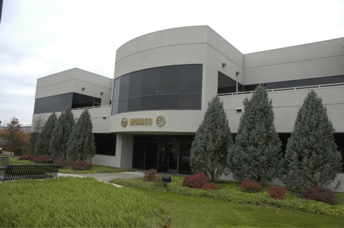
As is typical for these tours, cameras are not allowed, so I have no photos from inside the plant. But I can tell you it’s a great tour with lots of opportunities to get very close to all phases of the process. We watched as the motorhomes were welded together literally from the ground up starting with 3×8 box sections of steel for the frame rails. Monaco builds the whole coach including the chassis, whereas most manufacturers buy their chassis already pre-built, so you get to see just about everything that goes into making a motorhome.
Emma liked watching the process of heating and stretching vinyl to make dashboards, which looked like a giant art project that a kid could enjoy, but otherwise she wasn’t fascinated with the factory. But she was a good sport about it and we rewarded her with lunch at Subway, a kid favorite. I found everything interesting, and came out of the tour thinking what a well-built product Monaco made, which was precisely the point of the tour. Only two things hold me back from buying one right now:
1) Like most Class A motorhome manufacturers, they don’t make a two-bedroom floorplan.
2) I don’t have $500-800k to blow.
But otherwise, I was that close to writing a check on the spot. So I’d better not take the Marathon Coach tour. Those babies, built on Volvo bus chassis and highly customized, often run over a million bucks. I can’t even afford a tank of diesel in one of those…
We’ve moved on to our next stop, Valley of the Rogue State Park, between Grants Pass and Medford OR. We’ll spend Halloween here and take a couple of days to get other things done before heading into California.
October 28, 2007 at 7:29 pm · Filed under Places to go
I remember spending Sundays at home when we lived in a house. I always felt challenged to find something different to do on Sunday in the winter, because otherwise there would be a tedious sameness to the day and by nightfall I would be feeling as though I had spent a day pacing a jail cell.
 One of the things I like about moving around more or less constantly is that when Sunday rolls around there’s usually something new to explore. I’m not one for watching football, or walking the same walk with the dog. Even in a little town like Astoria there’s a bouquet of novel things to see and do, so Emma and I headed out today while Eleanor stayed back to finalize Emma’s Halloween costume.
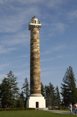
Astoria is sort of a tiny version of San Francisco, a town with a harbor, a long bridge, a steep hill, and lots of interesting Victorian houses. Atop the big hill is Astoria’s version of Coit Tower, called the Astoria Tower. Take a couple hundred spiral steps up to the top and you get a superb 360 degree view of town, the Columbia River, the Pacific Ocean, and the inland forests.
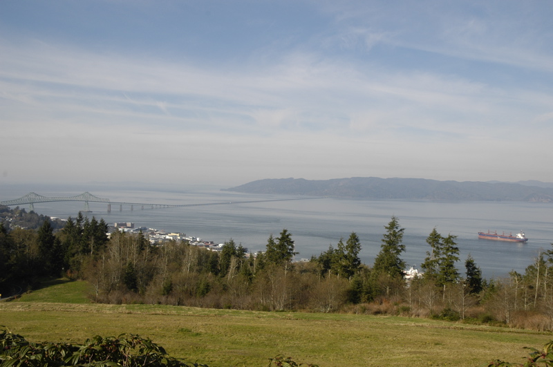
Down by the river there’s a long multi-use trail that follows the river and reveals the remnants of a dozen canneries, several ocean-going ships anchored (waiting for a chance to go up the ship channel to Portland), a Maritime Museum, several piers covered mostly with restaurants, and a cute rickety old wooden trolley running east and west.
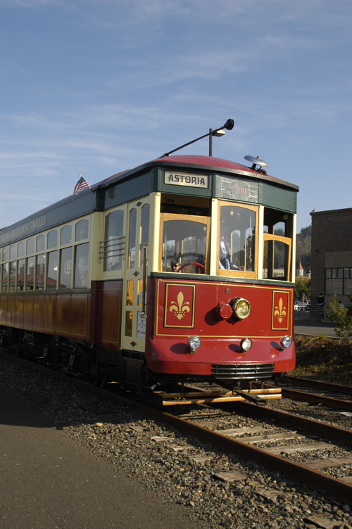 We walked most of the trail, down to Pier 39, and then picked up the trolley for the ride back. You can ride as much as you want for just a buck — a bargain — and the volunteers who run it tell stories about the history of the waterfront as it rumbles and creaks along the rusty rails.
From downtown we headed over to Fort Stevens, a state park just up the road from our current campground. I’d much prefer to have camped here, but cell phones are marginal in some of the camping areas and given that we needed a lot of communication when we arrived, we opted for a safer location.
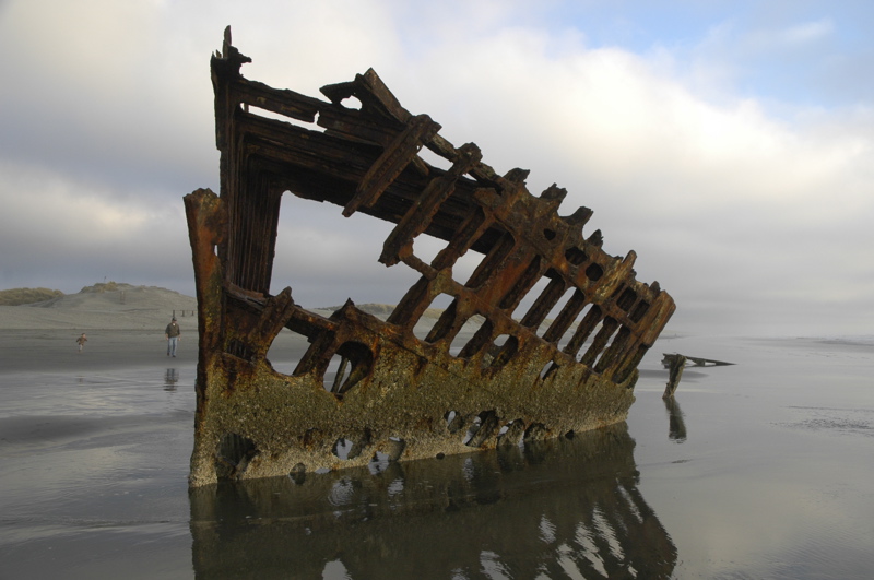
Fort Stevens is a large state park, with great bicycling trails, long stretches of beach, big dunes, good campsites, historic sites, views, and even a shipwreck. The Peter Iredale ran aground here about a century ago, and the bones of the steel ship are still embedded in the dense sand just off the beach. Stripped of just about everything and perpetually leaning hard to port, the Peter Iredale is a skeleton. People walk up, snap a picture, and walk away, but I like to look at it a while and imagine how the ship appeared in life, and imagine what it was like the day it crashed ashore.
And speaking of skeletons, Halloween is looming. When we returned to the Airstream the costume was still in process, and it will be tough for Eleanor to get it done by Wednesday, particularly if we don’t have an electric hookup on Monday or Tuesday night to run the sewing machine. We also don’t know where we’ll be for Halloween, but we are aiming at southern Oregon to meet up with another 7-year-old girl who happens to full-time in an Airstream. More on that later.
October 27, 2007 at 9:08 pm · Filed under Places to go
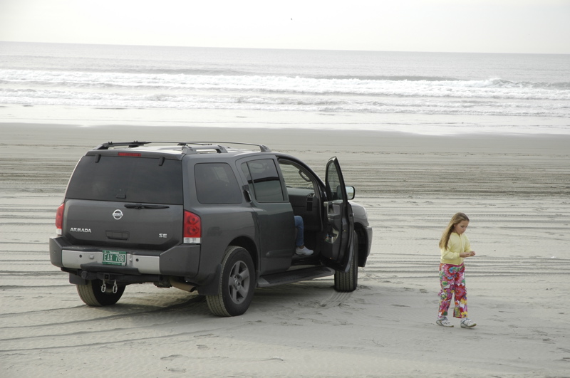
Just down Route 101 from Warrenton we found another little surprise, Sunset Beach State Recreation Area. Just take a westerly turn and drive until you hit the sand (just past the trailhead for the Fort to Sea Trail) then head south along hard-packed gray sand toward Seaside.
You can drive for miles along this beach. I expect in the summer it might get pretty busy, but on a chilly Saturday in October there were probably only two dozen vehicles on the sand in four or five miles.
This would be a sweet spot to park the Airstream for a day at the beach. Overnight stays aren’t allowed, but you could easily put the trailer on the sand as a private cabana. We might even do that on Monday if we get out of the RV shop early enough.
October 26, 2007 at 9:39 pm · Filed under Places to go, Roadtrips
Things are turning around. The makers of our disc brake actuator, Active Technologies, came through promptly with some good news this morning. They have a few refurbished units which match ours, and put one in a box destined for delivery to us on Monday. This is better than getting the newer unit because it will be a direct-fit replacement and thus won’t mystify the local RV repair shop quite as much.
With this happy news, we embarked fifty miles south to Tillamook. Our friend Gunny has been parked in Salem in his Airstream 25FB, patiently waiting for us to show up and visit. I was worried we’d be forced to skip past Salem by the ripples from this delay, so we invited him to meet us at the Tillamook Dairy.
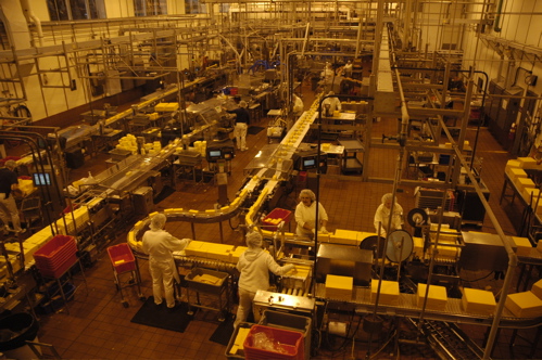
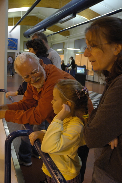 The dairy is the major attraction of Tillamook. Even now, in the off-season, the parking lot is busy with hundreds of vehicles coming and going all day. The Dairy is a cheese factory, with a casual restaurant and a couple of ice cream bars inside too. You can take a self-guided tour overlooking the production lines, which is fun for people from 7 to 60-something years of age, as we proved today.
There are a couple of other tours along this stretch of Rt 101, according to Factory Tours USA. These include Pacific Oyster, just a couple of miles north of Tillamook, and The Real Oregon Gift Myrtlewood Company a bit further north. We dropped in on Pacific Oyster but there’s only an oyster shucking operation to see and the line was closed when we arrived.
Route 101 is the real star of this trip. The road rolls and sways, dipping into cedar forest and then rising far above the ocean to reveal stunning views. It’s like this all the way from here to Humboldt County in northern California.
Seaside Oregon is another little gem along this route. This town looks like just a strip mall from Route 101, but if you head west across the river at Avenue G, you’ll find the Lewis and Clark Salt Works location neatly enshrined among a neighborhood of cute little shingled cottages. Park here and walk to the water. Seaside has a large flat beach insulated from the neighborhood by a deep barrier of sea oats, and it’s really beautiful. In the early evening we found dozens of people crabbing in the low tide zone while the orange sun set cast reflections on the skim of water that still covered the sand.
Now it is starting to feel like there won’t be time to visit all the things we want to see in this area. That’s perfect. I’d much rather feel I left a spot a little too early, than feeling like I stayed too long.
October 21, 2007 at 7:25 pm · Filed under Places to go
Normally I look for sunny weather, but if we had come to a rain forest (the first real rain forest we’ve camped in) and it had not been raining I would have been disappointed. I envisioned something primeval and dark, with moss hanging from everything, and a constant state of rain that fluctuated between drips from the giant tree leaves and steady showers.
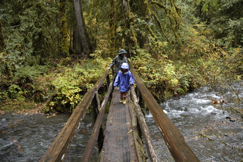
So I have not been disappointed. The Hoh Valley is the perfect place to make rain. Moist Pacific air comes to land, carried by the “Westerlies” (an onshore breeze), and funnels into the Hoh Valley as it is pushed up by the rising landscape of the Olympic Mountain Range. Inevitably it cools and precipitates down to the giant trees that thrive in this mild wet spot, to the tune of 140 inches of rain each year. By comparison, our home base of southern Arizona gets only about a dozen inches of rain each year.
The Hoh Rain Forest will get 22-30 inches of rain this month, since we are approaching the really wet winter season. We drove through light to moderate showers for forty miles along Rt 101 and up the 20-mile Hoh Valley road, and as we approached the park interior the trees kept getting bigger and the forest grew more dramatic. The big leaves that cover the ground everywhere are from the appropriately-named “Big Leaf Maple” and they are often a foot wide. The moss finds purchase nearly everywhere, including trees, bridges, rocks, unused handrails “¦ any spot that is relatively undisturbed by the friction of feet, hooves, or water.
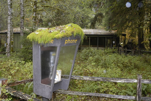
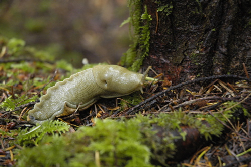
This time of year there are predictably few visitors, but I think this may be the best time to really experience the Hoh Rain Forest. It gets cold up above 3,500 feet, and snow is falling up there, but not here. The temperature has remained nearly constant at 47-52 degrees, a good temperature for hiking, and the air is still. Yesterday on the drive over we stopped to hike to Marymere Falls (an easy 1.5 mile roundtrip near Lake Crescent) and it was so comfortable that we spent most of the time in the forest studying the diversity of mushrooms and banana slugs that live in there, recycling the downed trees. Only near the falls, where a breeze was being generated, did it feel the slightest bit chilly.
Here in “the Hoh” they are predicting an unusual event for Monday, partly sunny skies and up to 61 degrees. I might even feel a little disappointed if it comes true. While we are here it may as well rain as much as possible, so we’ll never lose the sensation of being in the rain forest while we are camped.
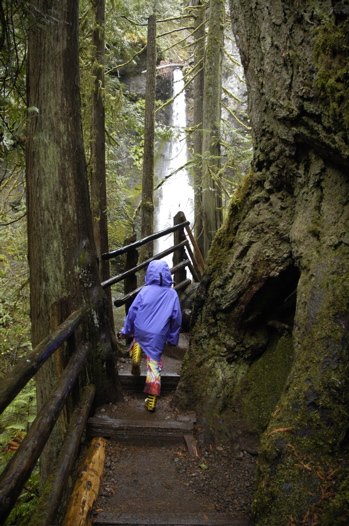 On the way here we passed one of Olympic’s record-setting giant trees. The moist climate allows Sitka Spruce to grow here, and there’s one near the road that is over 500 years old and 12 feet wide. Towering 270 feet straight up, it is impossible to photograph accurately. I have tried many times over the years to capture in a photo the sensation of standing beside a mammoth tree like this and each time I have failed. You really have to experience it yourself. It is an extraordinary thing, and even more thrilling when you realize that this country used to be covered in massive old-growth trees like this. Imagine walking through a forest filled with huge trees ranging from four to fifteen feet at their bases, and with the canopy 200-300 feet above your head. It’s kind of thing we only see in movies, or in those rare remaining spots where true old-growth forests still exist.
In the Visitor Center we bought Emma a little laminated booklet that helps identify animal tracks and scat. Right away we had opportunity to use it, because there are numerous piles of fresh scat only a few feet from our campsite, probably Elk.
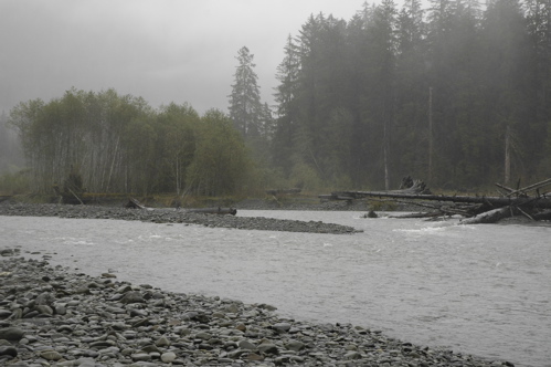
To one side of the Airstream is the rushing gray river, deep and fierce and wild-looking. It is bounded by fields of rounded rocks, tall pines and cedars, and dramatic valley landscape. To the other side we can see only trees disappearing into the fog, and above us there is an ever-present gray sky. Although the campground is quite civilized, and the water is never turned off here, there are only two other campers.
As you might expect, we are not getting much power from the solar panels. Not only is it constantly cloudy here, but tall trees shade every campsite, every parking spot, and even the road-side pull-outs. We voluntarily spent last night in the non-electric part of Salt Creek Recreation Area, but I mistakenly left the middle Fantastic Vent wide open all night, and as a result the furnace ran far too much. This used up 43% of our battery capacity in one night! (Have I mentioned lately how annoyed I am at the inefficiency of RV furnaces? I can’t wait to get that catalytic heater installed.) If we had the standard two batteries installed they would have been dead in the morning, but fortunately we’ve got four.
So we started off in Hoh with only about half our power bank remaining, and picked up virtually no solar power during the day on Sunday. Fortunately, the mild nights here mean that if I remember to close the vent tonight we will use much less power for the furnace. We should be fine for one more night before we head to the coast.
In any case, I’m not worrying about it. We watched a movie on the laptop and Eleanor and Emma baked an apple crisp using apples they’d picked from Janie’s tree in Montana. The trailer smells homey from the baked crisp, while the constant patter of rain on the aluminum is a reminder of the unusual place we’re in.
October 20, 2007 at 8:21 pm · Filed under Places to go
The knock on the door always seems to come at the worst time. Eleanor was in the shower, I was on the phone and still wearing pajamas, and our neighbors in the campground had come to visit. They were wonderful people, the Ritcheys, former Airstream owners and full of enthusiasm, and I can’t fault them for thinking we might be presentable at 10 a.m.
They live on the Olympic Peninsula, and having borrowed our open wi-fi signal and read the blog that said we were headed to the Peninsula, they felt it was only fair to return the favor of free Internet with some advice about where to go.
Eventually Eleanor and I got presentable — while talking — by sort of tag-teaming our guests. I managed to get dressed and brush my teeth while having a running conversation, and Eleanor picked up when I couldn’t.
This multi-tasking continued right up to the point when Eleanor went to dump the tanks. Naturally, the rest of us bunched up toward the hitch end of things, where I was about to demonstrate the process of connecting a Hensley. Just then, Eleanor reported in a distressed tone of voice (you’ll have to imagine it) that she had just had “a sewer accident”.
Since I am the primary tank-dumper in the family, Eleanor has never experienced the joy of a sewer malfunction. I am embarrassed to admit that my first reaction was to laugh. In this case, the sewer had backed up from the “full hookup” connection and overflowed onto the ground.
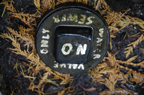 Last night I reported that we had a full hookup at $21 in this campground, a bargain. But I didn’t actually connect things last night, Eleanor did. There was a cap with some writing on it. Eleanor glanced at this and saw the words, “Water,” “Sewer” and “ON” and assumed it was a sewer outlet.
Nope.
What it actually says is better revealed in the second photo, which shows the cap right-side up. This is in fact a cover for a valve to shut off the water supply in winter.
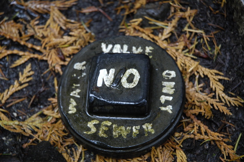 Now, if I were the guy who had to shut off this water valve each season, I’d probably take much more aggressive steps to prevent people from accidentally confusing this with a sewer dump. Just one person, say for example a female person trying to help her husband and working in near-darkness, who finds this 4″ pipe that looks just like a sewer dump, in exactly the spot you’d expect to find a sewer dump, and who doesn’t carefully study the arcane inscription on the cap, and accidentally dumps a load of raw sewage down it … well, it certainly is a formula for ruining everyone’s day. The pipe is several feet deep and that’s a lot of you-know-what down the hole.
Well, let’s just cut to the conclusion. The situation was eventually cleaned up, mostly, and various people were cleaned up, and we fled, um, “departed” the campground for a very nice drive through Fidalgo and Whidbey islands. I don’t think Eleanor saw much during the first 15 minutes because she was liberally applying Purell to her hands and talking about how we were going to get a bill from the City for this episode.
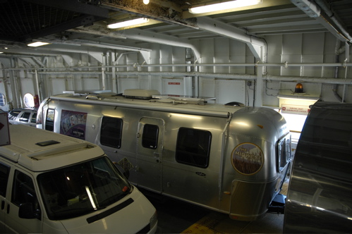
I think in the course of driving through the islands for an hour we experienced half a dozen major weather shifts. Eventually we ended up on the M/V Klickitat, a ferry originally built in 1927, to Port Townsend.
Our friends from the campground steered us well. When we got to the Olympic National Park visitor center, we found that in addition to the seasonal campground closures that we knew about, two more campgrounds and a couple of roads were closed due to recent severe weather. This eliminated quite a bit of what we wanted to do on the first day in Olympic, so we decided to try one of the campgrounds suggested by the Ritcheys, Salt Creek Recreation Area (a county park).
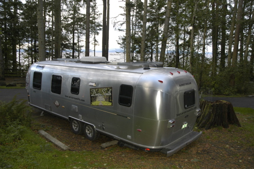
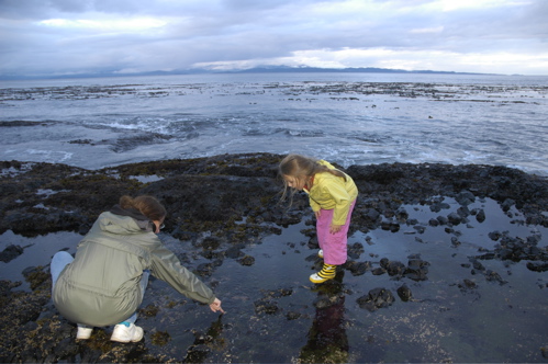
Excellent find. This campground is right on the water, with most of the campsites just a few feet from a rocky bluff and an awesome view. There’s a water-electric hookup area, but it’s more sterile. Go to the no-hookup back loop (sites 59 and above) and you’re in the cedar forest. The sites are short but we managed to get the 30-foot Airstream parked without much trouble. A short hiking trail brings you to several beautiful overlooks, and at three points you can take stairs down to tide pools.
This campground was once a WWII gun emplacement, called Camp Hayden. The massive gun bunkers are still here and you can walk through them, along with some observation bunkers closer to the water. In fact, to go to the dump station you have to drive your RV through two of the bunkers! I’ll have to get a picture of that tomorrow, when we go dump … very carefully.
October 14, 2007 at 5:05 pm · Filed under Places to go
It should be no surprise that it is cold here. Every morning we have heavy frost on the ground and the snow we see at the mountain peaks is in no danger of melting. But during the day the sun has been pleasantly warming us and the Airstream, so that we are encouraged to go outside and explore. Today the warming was a bit slower than forecast. By 11 a.m. it was still in the 30s (or as I should say since we are in Canada, about 2 degrees C).
We decided we were more interested in things north of here so we hitched up the Airstream and towed it 57 km up to Lake Louise. No reservations needed (or accepted) here either, this time of year. The national park campground is mostly closed down and in the one remaining open loop we are one of about six campers.
The village of Lake Louise is a much smaller place than Banff, with just a couple of streets and no large residential areas like Banff. The basics are here: a few stores, four or five restaurants, gas, repairs, medical care, visitor center, etc. There aren’t many people.
 The campground is the northernmost one still open. All of the campgrounds in the neighboring national parks (Jasper, Yoho, Glacier, Mount Revelstoke, Kootenay) are closed for the season. Several people suggested we roam further north to Jasper National Park (227 km, 140 miles), but we can’t stay there without some place to camp, and it’s too long for a satisfying day trip.
Even here, the water has been turned off in the dump station. We found a single spigot near our campsite that still works, so we refilled our fresh water holding tank. Normally water is easy to find, but this time of year in Canada I’ve learned that we can’t take it for granted. We will be watching our water use carefully once we leave this spot.
The closure of the campgrounds will make things logistically tricky for us when we leave. There are Provincial Parks with campgrounds along our route, but we don’t know which ones are still open for camping. Normally I’d spend a half hour on the Internet researching and planning but we’re a bit limited there too. I found wifi in Lake Louise and that’s how I got the last couple of blog entries online. It’s $5 per day if you use your own laptop and work outside (the store that offers this service is very small, so there’s no seating inside.) I joined a group of Asian tourists who were all sitting outside in the 40-degree weather with their laptops. Unfortunately, I had to deal with a few last-minute issues related to the Winter 2007 magazine, and by the time I was done dealing with those, my laptop battery was flat and my butt was freezing from sitting on bare concrete outdoors. So, no time to research campgrounds. We’ll wing it.
By the way, a big kudos to blog reader Melanie who spotted the misspelling of Pete Townshend’s name on our Winter 2007 cover. Can you believe that four people reviewed that cover and nobody spotted it? I am grateful for you blog readers who are always there to lend a hand, on everything from yogurt to camping to spelling. In another 48 hours it would have been too late to fix it “¦
 The big target for today was the Chateau Lake Louise, and the incredibly beautiful area surrounding it. The Chateau, as I mentioned yesterday, was part of the Canadian Pacific Railway hotel chain, originally built around the turn of the century (no, the other turn of the century) and extended and rebuilt several times since then. It was a way of boosting railway travel by bringing tourists to the scenery.
Lake Louise has an eery translucent green color to it. It drains through a creek and is very cold, so all the trees that fall into it don’t wash out, and they decay very slowly. Many of them are visible in the shallow end, making the lake look as if a hundred ice-fishing cabins fell into it. High above the lake is a glacier, looking like a giant snowdrift, and the sharp glacially-carved ridges that define this area.
A short (3.2 km roundtrip) and steep hike through the pine forest will bring you to a really terrific overlook of the lake and the Chateau. I recommend it for anyone who can hike. But if you won’t be getting up there soon, check out the photo “¦
« Previous entries ·
Next entries »


