Archive for Places to go
June 10, 2006 at 9:48 am · Filed under Places to go
I have to say that choose the twisting, roller-coaster road that is SR 299 through California was a great decision. (Rich C says it’s a better decision for people with disc brakes, which he doesn’t have — yet.) The road follows the Trinity River past dozens of beautiful campgrounds, river rafting companies, fishing spots, and generally fantastic scenery.
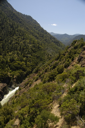
The water is dam-controlled, and the release schedule called for lots of water last week and this, so river rafters were having a great time. We really wanted to stop and catch a rafting trip, but with our reservations at Humboldt in place, we decided to press on. That’s the problem with firm plans. That’s why we generally avoid making reservations!
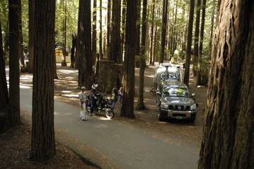
We swung through Eureka to pick up our mail (a familiar post office, since we got mail there last November, the day before Thanksgiving), and then headed straight down Rt 101, “The Redwood Highway” to the park. It is just as amazing and beautiful as we remembered it.
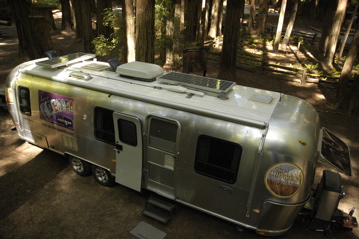
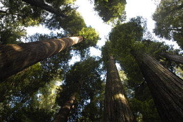
One thing we forgot, however, was how dark it gets in the redwood forests. Rich C arrived ahead of us and scouted out a nice spot for us. (The campground has very few sites that will comfortably accommodate a 30-foot trailer.) As you can see from the picture above, we won’t be getting much solar power.
Rich C was shocked at how little sunlight reached the ground. Inside the Airstreams, with the tinted windows, it is so dark we need lights all day long. But just a few hundred feet away in a clearing, brilliant bright sunlight is pouring down. It’s strange.
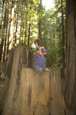
We feel like hobbits in here. It is quiet and primeval in the forest, but also a tiny bit spooky. The scale of the trees and even the stumps dwarf us.
We are pretty sure we are going to reserve a third night (Sunday) so we have plenty of time to hike and explore the area. But that’s going to be the limit. Rich C came over this morning to say, “I like it here, but if we spend too many days here I’m going to get depressed [from the dark]!” which is pretty much what we all were thinking.
Last night we did a short nature trail hike (0.6 miles) and checked out the excellent Visitor Center, and today we have a couple of hikes in mind. Rich C wants to go get a re-supply of his Jelly Bellys (jelly beans) today, and we might even go check out a light house. We’re winging it.
This blog entry comes to your courtesy of Rich C, which spent half an hour last night wandering around the campground with his cell phone to find the best signal. He lucked out and got online, and I’m stealing his wifi signal from 200 feet away, with my Linksys repeater running off an inverter in the Nissan. That means I should be able to update the blog again tomorrow.
June 7, 2006 at 7:00 pm · Filed under Places to go
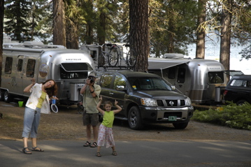
We’re all glad we decided to stay another night here. Rich C and I had lighter work days, and we all took off to the tiny town of Chester to explore. It’s a cute little town, populated with people who work for the National Forest Service and people supporting the influx of campers who occupy this place seasonally. But other than getting a haircut, dropping the mail and picking up some groceries, our visit to town was pretty quiet.

Walking along the abandoned railroad tracks that pass the campground was more fun, in a way. The tracks lead past a place where eagles and turkey vultures circle overhead all afternoon, looking for dead carp by the shoreline. Then the view opens up to the expansive Lake Almanor, with fly fisherman and mountains in the distance.

Lake Almanor feels like the northeast forests of home. We can imagine being in the Adirondacks, except that the pines are much bigger (ponderosa pines), towering over us like redwoods. It’s a pleasant place to be, except for the thick yellow pollen that has coated everything. (Fortunately it doesn’t seem to be bothering Eleanor unduly.)
We’ll be leaving tomorrow, to start heading west to the coast. We’ve decided to make an overnight stop at a National Forest campground about 100 miles from here, and then spend the weekend at Humboldt Redwoods State Park. We may be out of touch again due to limited cellular coverage, but I’ll update as soon as possible.

June 6, 2006 at 8:30 pm · Filed under Places to go
It is beautiful here, but I hardly saw any of it today. Neither did Rich C. We spent the day hunkered down in front of our laptops, working on various projects. My major breaks were taken when I had phone calls; then I was free to wander around the campground while talking.
Emma was working too. She was practicing reading with Eleanor, and around lunchtime she came and read me a short silly story about ducks in a tub. So we all made progress on something.
We did get a nice family walk (with Rich C) along the shore around 7 pm, after grilling some dinner outside. We saw eagles soaring in slow circles above the shoreline, and watched the beginning of the sunset over the water. This really is a great and peaceful place to camp.
Given that (a) it is gorgeous here by the shore of Lake Almanor; (b) we’re having great weather (dry, sunny, 70s); (c) we aren’t in any hurry, we have decided to stay one more night. Tomorrow I hope my phone won’t ring much and there won’t be any problems with the website or store … so I can take a day off to explore the nearby town of Chester and get you some photos of this really great spot.
May 31, 2006 at 11:08 am · Filed under Places to go
Our visit to Death Valley has been too short, but unfortunately work intrudes. Cell phone service is limited to spotty analog coverage, and I’ve had seven dropped calls this morning in an attempt to accomplish one short task. Forget about Internet service. We will mark Death Valley as a spot to return to again, perhaps next winter.
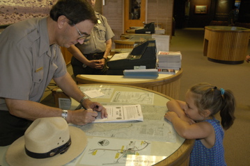
Before we left, Emma completed her Junior Ranger activities and we went to the Visitor Center to get reviewed by the rangers there. Emma managed to complete more activities in the book than are required for her age group,
The drive west out of the park is a tough one for any car, which is why the park service spots tanks of “radiator water” alongside the road. A sign says “Prevent overheating ““ turn off A/C next 20 miles”. The road climbs over the Panamint Range to 5000 feet, and even though we got on the road by 10:30, it was already 95 degrees.
The Nissan did very well for a truck hauling an 8000 lb trailer up 5000 feet vertically. As the road steepened, we did need to downshift to keep the engine RPM high. Higher RPM helps the engine and transmission cooling. Eventually, we needed to slow to about 25 MPH in first gear. There was plenty of power, but trying to go faster we would risk overheating.
Another tip I would give any Airstreamer coming out of Death Valley is to be sure to have plenty of fuel. Climbing up these hills, you won’t get the usual fuel economy. We chewed up a half tank in no time at all, and were forced to stop at one of the tiny outposts on the way west for fuel at a painful $3.76 per gallon. I bought five gallons, and was reminded of the last time I was in Italy, paying about the same rate.
Eventually Rt 190 meets Rt 395 at Lone Pine, and 395 heads north through the Owens Valley. This is an amazingly scenic drive. The sharp and snow-capped peaks of the Sierra Nevadas loom to the west. The valley is green and quiet, and to the east are the dusty brown desert foothills of the Inyo Mountains. This is wonderful country, magnificently isolated by the walls of rock to the west, and the hundreds of miles of scorching desert to the east.
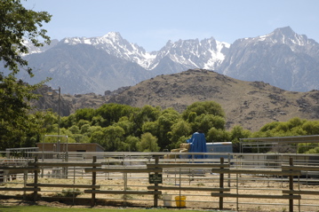
Traveling north we passed through a series of small towns (Independence, Big Pine, Bishop), slowly climbing up the tilted valley floor. To our left we passed the east entrances of King’s Canyon, Sequoia, and Yosemite National Parks, but one glance at the steep winding roads told us we would have a tough time entering through those back doors. In fact, the roads to Yosemite and Devil’s Postpile National Monument are still closed for snow. The snow in the mountains that looked so far away from yesterday’s hike at Dante’s View got closer and closer. It was hard to believe we were heading toward it, with the memory of 100 degree temperatures and scorching hot beds still fresh.
In fact, the latent heat of Death Valley is still with us. We’re now around 7,000 feet in the town of Mammoth Lakes, where we are parked in the National Forest campground ($15, no hookups). When we arrived, the outside air was a mild 61 degrees, but when I opened a storage compartment in the back of the Airstream, I was surprised by a blast of heat. Every closet and cubby is the same way: storing the dry hot air of Death Valley. The interior of the trailer was 82 at 9 pm this evening. It may take most of the night to cool the trailer off, but at least we will have a much more comfortable night’s sleep.
May 29, 2006 at 10:14 pm · Filed under Places to go
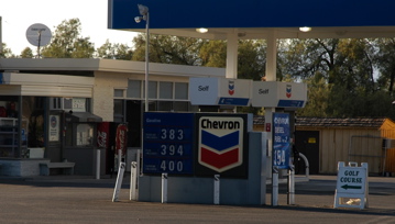
From Las Vegas it’s about 100-150 miles to Death Valley, depending on which way you go. But regardless, it’s a long lonely road through hills and desert, with only a few outposts along the way. We tanked up in Las Vegas before we left at the best price around, $3.05 per gallon, because it certainly wasn’t going to get cheaper as we went into the desert. We stopped again later for a 10 gallon top-off at $3.19 per gallon … and I was glad because as we arrived in Death Valley, the only gas station had somewhat higher prices…
Since our last visit to Death Valley in 1997, the park service has cut a deal with the local Native American tribe, the Timbisha Shoshone. They now have a private area in the heart of the valley near Furnace Creek, nearly 200 feet below sea level. It’s a tough place to live; not much water, and excruciating heat all summer.
We were lucky to get relatively mild temperatures. When we arrived it was in the low 90s, but we knew it would get hotter the next day, so we picked out a campsite in the Furnace Creek campground that was partially shaded. The idea is to have a spot where both solar panels would get full sun most of the day, but the tamarisk trees would shade half the trailer in the late afternoon.
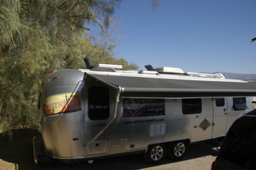
You’re probably thinking, “Hang on — no hookups in that campground?” Yes. That means no air conditioning. So we expect that our two Fantastic Vents and plenty of solar power will be the keys to survival. The forecast for tomorrow is 100 degrees. Even tonight it’s not going to cool much. At 10 pm, as I write this, it is still well into the 80s. Death Valley doesn’t cool off at night much. The surrounding mountains trap the warm air. That’s one of the reasons it is so hot here.
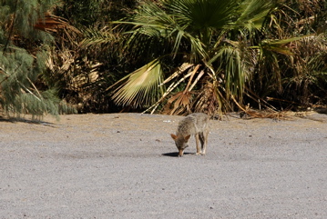
But it is beautiful. The views and wildlife are everywhere. During the afternoon we spotted a coyote wandering by. At sunset we were able to walk around and spot dozens of bats catching their dinners in the red dusk of sunset. I am sure, despite the heat, we will have a good time.
May 27, 2006 at 8:23 pm · Filed under Places to go
As promised, Brett and I went jetskiing on Lake Mead today. We learned a lot: what not to pack, how not to dock the boat, how not to protect one’s cell phone, and what size waves one should not attempt to fly over at 35 MPH. It was a very educational session.
The basis for most of our education was high wind. It was blowing between 20 and 30 knots on Lake Mead, with gusts up to 54. This meant waves up to 4 feet in the middle of the lake. It was also mostly cloudy and the air temperature never got above the 70s, amazingly enough.
So while this kept the lake free of competing boat traffic, it also meant a rough ride on the open water. The spray from our boats either outran us, or flew back into our faces like little needles, depending on which way we were heading.
The pounding of the waves caused our can of Pringles chips to become Pringles mulch. One bottle of cranberry juice flew out and is now resting at the bottom of Lake Mead. The plastic baggie containing our cell phones shredded, and the red Gatorade leaked onto everything. Brett is eating ibuprofen for dinner and I look like I’ve got a horrible skin disease from the dried minerals on my arms and legs.
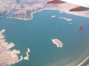
Arrow indicates approximate location of cranberry juice
Still, it was fun. The protected coves gave us plenty of room to play around, and we were able to boat within a few hundred yards of Hoover Dam. The canyons and inlets are gorgeous and fun to explore. We logged about four hours on each boat (not counting snack breaks), and with our shorty wetsuits we were reasonably warm despite the strong wind. We’re already talking about going again next year.
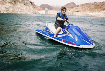
Brett on the wet side of Boulder Dam
After returning the rental boats, we headed back to the Airstream for a change of clothes and then to Hoover Dam. About this time my cell phone dried out and began to work again. Brett’s phone got wetter and it seems to be non-functional, unfortunately. So while it was drying out on the dashboard, we checked out the incredible Hoover Dam, built from 1931-1935 on the Colorado River about 300 miles southwest of the Glen Canyon Dam we visited just a couple of weeks ago.
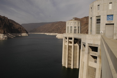
The dam tour is worth doing, at $11 for adults. Not only do you get to go down inside the dam, but the new exhibit building (the copper-colored structure in the right of the photo below) is very good. And the views are tremendous in every direction.
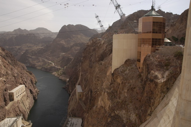
I was also impressed with the town of Boulder City, which is the home of the Hoover Dam. It has a vibrant downtown, lots of culture and activity, is not too touristy, and sits in a scenic spot just 20 minutes from Las Vegas. We may check it out further when Eleanor and Emma get back, if there’s some time on Monday.
Here’s a Sign Of The Week for you, as found in Boulder City.
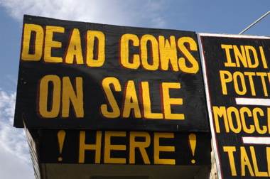
May 19, 2006 at 10:13 pm · Filed under Places to go
This morning Emma was pleased to find that her homeschool project of growing some herbs has yielded seedlings, and she insisted I take a picture of them. The desert sun and some nice soil donated by friends in Texas has caused her cilantro and chive to pop up.

The drive from Glen Canyon National Recreation Area to Zion National Park is all scenic. Along the way, we got glimpses of Grand Staircase-Escalante National Monument, and Vermillion Cliffs, and passed through the little town of Kanab. The scenery ranges from dunes to “painted desert” to scrubby evergreen forests and finally to red sandstone.
We had heard from friends over the years that Zion was marvelous, but nothing prepared us for how incredible it is. We came in the east entrance, which brings you along an incredible and impossibly winding road and through two tunnels blasted out of the sandstone.
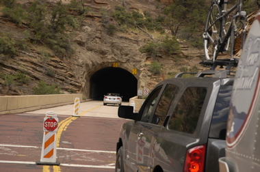
The second tunnel is narrow and for the past decade the park service has required “large vehicles” including all RVs to pay a fee of $15 to go through it. They have rangers stationed at either end who stop traffic so that RVs can go right down the middle. Basically, for the $15 you get to rent the entire tunnel for your private use for a few minutes. We made the most of it, cruising the long (nearly a mile!) and dark tunnel (no lighting at all) at a leisurely 20 MPH.

Once arrived in Zion Canyon, you can’t help but be absolutely amazed. Every direction is an incredible scenic view of towering sandstone walls, over 1000 feet high. Even though there is only one road leading north-south through the canyon, there is very little traffic because the Park Service instituted a shuttle system back in 2000. It works great. Just hop on the shuttle that runs every 7-10 minutes and you’ve got a free guided tour of the canyon with stops just about everywhere.
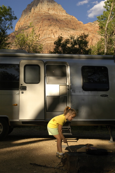
The weather is superb. It was well into the 90s today but only 36% humidity and it felt much cooler than it was. Our campsite is partially shaded but I expect we will have enough sun to recharge our batteries again. Amazingly, there is cell phone service here, and so we can keep the blog updated every night. So we’ve got everything we need plus some … and three nights to enjoy this great park.
Tonight it has dropped into the low 70s, so we can sleep with the windows open, and tomorrow the forecast is for 99 degrees. We plan to spend most of the day hiking some of the park’s signature trails in the shady parts of the canyon, near waterfalls and pools.
« Previous entries ·
Next entries »


